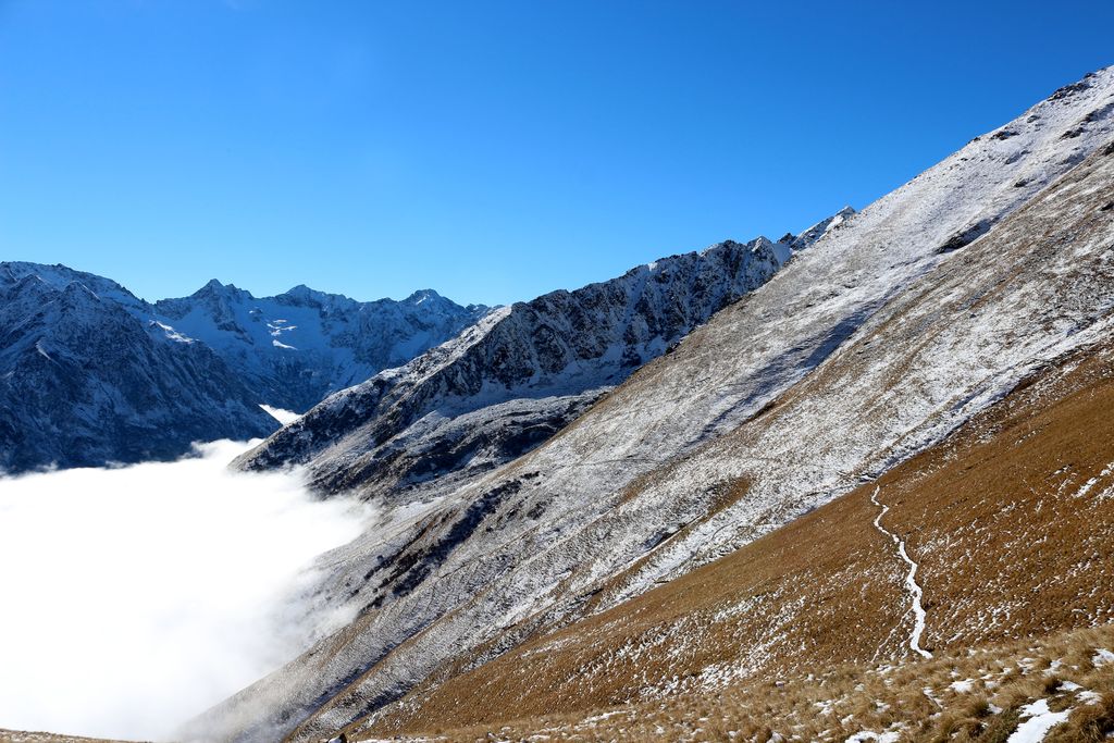
7. From Le Désert-en-Valjouffrey to Valsenestre via Col de Côte Belle (stage of the GR 54)
The stone world of Col de la Vaurze makes way for the alpine meadows, the kingdom of asphodels and marmots. Côte Belle, today's mountain pass, fully deserves its name (""Beautiful Slope""), making its green appearance as we leave the village of Le Désert. On the edge of the south-facing mountain pastures and the north-facing tall herb meadows, it is adorned with unique basalt columns. The enchanting break in the Béranger refuge in Valsenestre will bring you the rest you need before the next stage.
Description
Leave the village of Le Désert-en-Valjouffrey by the north and walk along the right bank of La Laisse mountain stream. From the sign announcing your arrival in the Ecrins national park, the footpath follows the stream until it crosses over it (1 420 m) to follow the left bank. At around 1700 m, change banks under the Combe des Marnes. The footpath is quite steep and winds its way up to 1950 m before cutting across to reach the Combe du Cognet.
- Take the right-hand footpath, which looks as if it will lead to the Col des Marmes, but which in fact has a fork further on towards Col de Côte Belle (2 290 m). Cross the rocky spur of the Pointe de Côte Belle and walk under the practically vertical basalt columns (2 140 m). The footpath then winds its way through the Valjouffrey national forest to join up with the Echerennes stream (1 550 m), which it runs parallel with at a distance, forming a small loop in the right bank as far as the intersection with Valsenestre (1 492 m).
- Then take the path opposite, leading to Valsenestre (1 295 m).
- Departure : Le Désert en Valjouffrey, Valjouffrey.
- Arrival : Valsenestre, Valjouffrey
- Towns crossed : Valjouffrey
17 points of interest
 History
Paravalanche
In 1961 and 1962 big avalanches descended as far as the riverbed of the Bonne, threatening the houses in the hamlet at Désert en Vajouffrey. In 1982 major works enabled the construction of a paravalanche in order to increase the safety of the hamlet and the prairies, by diverting possible threats coming from the Côte-belle valley.
 Geology and geography
New path
The last section of the path allows access to the mountain pass has required numerous days of maintenance since its creation. In fact the unstable character of the soil associated with the steepness of the slope have made it necessary for the rangers to create wooden benches to contain the weight of the earth.. In Autumn 2012, it was decided to create a new section of the path by using part of a sheep track further East in the direction of the Marmes mountain pass. The work was carried out by a team creating 50 m per day during 26 days with pick-axes and courage. In total, it is a section measuring 1300 m which has been created, which makes the path less steep and much more stable.
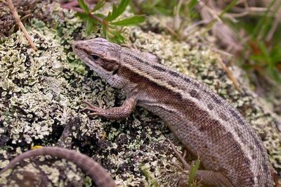
Lézard vivipare - Damien Combrisson - PNE  Fauna
FaunaViviparous Lizard
The viviparous lizard can be distinguished from the wall lizard by its rounded muzzle. It is capable of living at an altitude of 2500m and you will most often see them in the meadows. It likes to warm itself in the sun, resting on the grass or the dry moss to hunt grasshoppers, crickets or spiders. During the winter, it buries under the ground where in a lethargic state it can survive negative temperatures. The viviparous lizard is named like this because the females keep their eggs in their abdomen up until they hatch. So the young are completely formed when they are born, it is an adaptation to the cold environment.
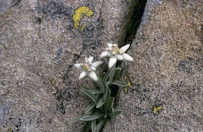
Edelweiss - Marie-Geneviève Nicolas - PNE  Flora
FloraEdelweiss
In Latin léontopodium signifies the foot of the lion which is the general shape of the edelweiss. By looking at it closely, you realize that it is not one flower but a group of 5 to 10 flowers grouped in a flower head. The edelweiss is in the astéracées family like dandelions. It is a white plant, milky and perennial growing in rocky alpine meadows at subalpine level up to 2900 m. It often mixes with the Alpine Aster. The emblem of numerous guides, it symbolizes the high mountains and represents strength in the language of flowers...
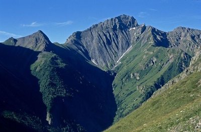
Pic de Valsenestre - Bernard Patin - PNE  Panorama
Landscape of the cirque de Valsenestre
From the mountain pass, climb the little summit above to better see the landscape which shows the cirque de Valsenestre : on the left is the Signal du Lauvitel (2901m) and the Clapier du Perron (3169m), the mountain pass at Muzelle (2613m) where the GR54 is. At this level you can really see a geological fault separating the Grandes Rousses which are granite from the Muzelle block in gneiss. On the right, the principal summits are the Roche de la Muzelle (3465 m), and the pointe Swan (3294m). Le col de Côte-Belle separates the Pic de Valsenestre (2752m) on the left from the l’Aiguille des Marmes (3046 m) on the right.
Saule soyeux - Bernard Nicollet - PNE FloraEuropean violet willow
This is a shrub in the subalpine tier. It is less than one metre tall and grows in small groups on the ubac. At lower altitude, it may grow taller. You can recognise it from a distance through its characteristic shiny, silvery colour and its growth in circular beds. Adult leaves feel very silky on both sides.
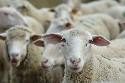
Troupeau de brebis - Mireille Coulon - PNE  Pastoralism
Flock of sheep
A flock of sheep belonging to local farmers graze at the summit of the mountain pass near the Pic de Valsenestre. In summer these animals with their thick woolly coats can enjoy the shade of the willows that you can see just before arriving at the col (alt. 2220 m).
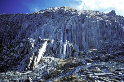
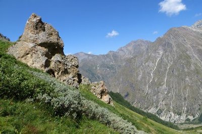
Les orgues au col de Côte Belle - Lucien Tron - PNE Geology and geographyCôte Belle organs
A striking geological phenomenon, the big organs , also known as the big library, were formed when the Alps were born. They were formed by thin grey-blue limestone sheets and by more highly eroded soft schistose marl. A series of perpendicular cracks in the layers divide the slabs into remarkable columns.
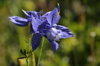
Ancolie des Alpes - Mireille Coulon - PNE FloraAlpine columbine
This is an uncommon and protected species, measuring 30 to 60 cm. The flowers are quite large and have a magnificent blue colour, blossoming at the head of the stem, and are the only ones with afive petals in the corolla. They are not to be confused with the common columbine, which has smaller flowers and is more widespread.
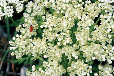
Pleurosperme d'Autriche - Bernard Nicollet FloraPleurospermum austriacum
This robust hardy perennial with a thick, hollow and grooved stalk belongs to the parsley and carrot family, and can grow from 60 to 150 cm high. Its large umbels of white flowers bloom from July to September. Very little known, in France it only grows in the Alpine areas and for this reason is worthy of attention.
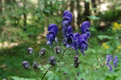
Aconit paniculé - Bernard Nicollet - PNE FloraMonkshood
This is a typical plant in tall herb fringe communities, measuring 50 to 100 cm. It has royal blue flowers shaped like helmets and grouped together in loose bunches. Their particularity is that they are highly toxic! Herbivores are aware of this and don’t eat them.
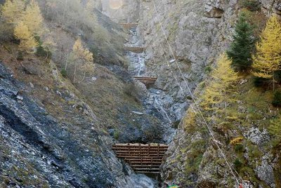
Barrages du torrent du Béranger - Samy Jendoubi - PNE  Water
WaterTimber dams
In the Combe des Echarennes, as you take the path to the left, you can see, in the gorges of the Béranger mountain stream, wooden dams made by the RTM (mountain terrain restoration department of the National Forests Office) to hold back the flow of debris carried down from the mountains during heavy rain and floods.
Mégaphorbiaie - Pierre-Emmanuel Dequest -PNE FloraTall herb fringe communities
Tall herb fringe communities form a landscape linked to very precise conditions in terms of climate (wet summers and snowy winters), topography (long ubac slopes where névé sometimes remains on the ground deep into the summer), altitude (subalpine tier from 1600 to 2100 metres) and soil (unsaturated soils with large water reserves).
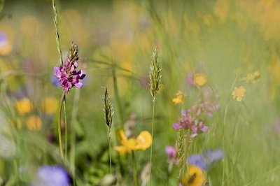
Prairie de fauche - Marc Corail - PNE FloraNatural Hayfields
Agricultural specialists consider a meadow as natural if it has not been ploughed or fertilised over the last ten years. This is the case for those that you will see, surrounded by hedges, at the start of the hike. The meadows have an important variety of plant life and consequently attract multitudes of pollinating insects, including domesticated bees of course.- Flora
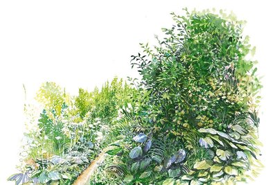
Alpine garden
More than fifty years ago, a botany lover, who is now elderly, created a small alpine garden in the centre of the village. Although it is less well kept nowadays, it still presents a stunning array of colour and a collection of spectacular plants belonging to alpine flora. 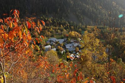
Valsenestre - Marion Digier - PNE HistoryViewpoint over the hamlet of Vasenestre
In the 19th century, the hamlet of Valsenestre had roughly one hundred inhabitants. The main activity was breeding. In 1851, a marble quarry opened in the bottom of the valley on the way up to the Muzelle pass. This was an opportunity for the village. It welcomed the quarry workers and benefitted from an improved road. Marble production stopped in 1905. Up until 1926, children laughing and shouting could still be heard in the village. The school had about thirty pupils. It was closed a few years later and the last permanent inhabitant of the village left in 1948.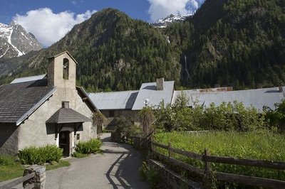
Le village de Valsenestre - Pascal Saulay - PNE  Architecture
Restored village
Valsenestre is a flower-filled village that has been superbly restored and is now made up of holiday homes The road is not cleared of snow in the winter. When the village had one hundred or so inhabitants it had a school (that has since been changed into a gîte d'étape (bed and breakfast halt), that closed in 1936. It was entirely buried by an avalanche in the 19th century. The main activity was still breeding but the opening of a marble quarry from 1840 brought complimentary resources to workers in the village. The last permanent inhabitant left Valsenestre in 1959.
Altimetric profile
Sensitive areas
Golden eagle
- Impacted practices:
- Aerial, , Vertical
- Sensitivity periods:
- JanFebMarAprMayJunJulAug
- Contact:
- Parc National des Écrins
Julien Charron
julien.charron@ecrins-parcnational.fr
Golden eagle
- Impacted practices:
- Aerial, , Vertical
- Sensitivity periods:
- JanFebMarAprMayJunJulAug
- Contact:
- Parc National des Écrins
Julien Charron
julien.charron@ecrins-parcnational.fr
Recommandations
Absence of markings over a large part of the mountain trail, but the footpath is easy to identify.

Source

Report a problem or an error
If you have found an error on this page or if you have noticed any problems during your hike, please report them to us here: