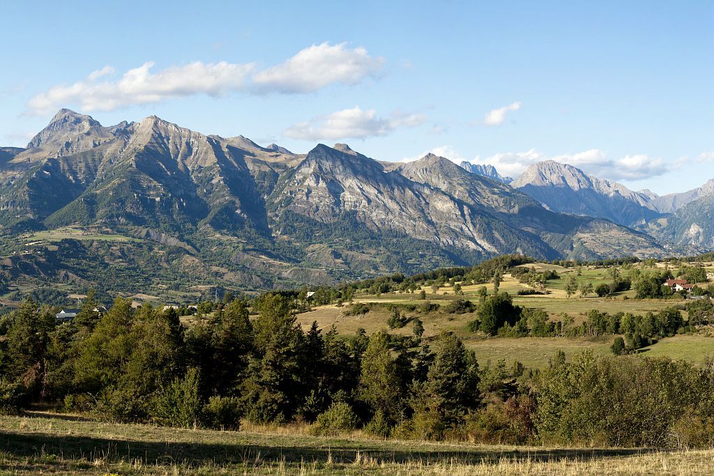
5. Tour of Vieux Chaillol - Stage 5 out of 5
In the Champsaur, there is extraordinary biological diversity and many people. This scattered lifestyle across several hamlets away from the larger towns such as Saint Bonnet, are due to an interesting past. Religious fervour has left its mark on the area by way of crosses and chapels. It was the subject of many conflicts between Catholics and Protestants, who assembled around the Duke of Lesdiguières.
Description
- Turn left and continue on the forestry road for another 500 m where, on the right, you will come to the footpath that leads into the larch forest.
- Walk past the footpath to the right that goes to the Pisse pass, and again on the right, the one that leads to the Viallet pass, and start a descent through the woods.
- When you leave the Lozière wood, cross the top of Les Combes. Enter the Barbeyroux wood and pick up the forestry route on the right.
- When you reach the roundabout, follow the road to the right that goes to the Subeyrannes forestry house and then go down to the village of Infourna Hauts.
- On the left at the exit of the hamlet, follow the paved road then the forestry road that leads to the Blache pass.
- From there head west following the wooded ridge. Cross a paved road (5 minutes to the left is the hamlet of L'Auberie and its strange chapel of the Petêtes).
- Go up through the Bois de Clier and as you leave it you will reach the hamlet de Charbillac along the road. Go through Charbillac and follow the road that then becomes a rough track leading to an enclosed meadow. Head down through the forest then once you have passed the Merdarel stream, go along the irrigation canal until you get to the bridge over the Séveraissette that will lead you to La Motte en Champsaur.
- From the post office square, the path continues up to the north-west to the hamlet of Le Collet. Go over the mountain pass of the same name, then start down on a shaded route on the paved road from Les Courts.
- Follow the road for 400 m, then a track to left, to 400 m of paved road, leading to Maisseret.
- The GR leaves the paved road by a rough track that bends until it reaches Les Costes water storage reservoir. 400 m into the forest, link up to the forestry road that heads down north-east, changes into a footpath and crosses the Costes irrigation canal. It is possible to get to Les Paris by a small footpath to the right.
- Departure : Chaillol
- Arrival : Les Paris
- Towns crossed : Saint-Michel-de-Chaillol, Saint-Bonnet-en-Champsaur, Bénévent-et-Charbillac, Les Infournas, La Motte-en-Champsaur, Les Costes, Chauffayer, and Saint-Jacques-en-Valgodemard
6 points of interest
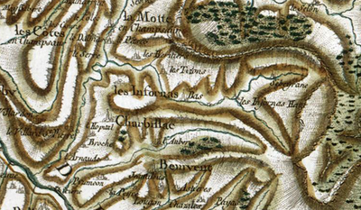
Carte de Cassini - IGN  History
The origin of the name "Champsaur"
A dozen origins explain the name "Champsaur". Obviously the prettiest one, and the least likely, is that it means "champ d'or" (Field of gold) as Napolean is said to have shouted out "what a beautiful field of gold" upon discovering the area. Other explanations are "field of lizards (sauros meaning lizard in greek) or "Sarrasins field" (campus sauracenorum) due to their numerous invasions. However, the most likely explanation is that it comes from "campus saurus" the field or the land of Saurus, the name of the owner at the time.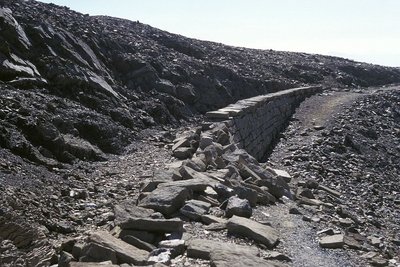
Le canal de Malcros en aval de la cabane des Parisiens - Gabriel Gonsolin - PNE  Vernacular heritage
Mal Cros Canal
Although it became necessary to create an irrigation system for the Champsaur as early as 1819, following a particularly severe drought, work on construction of a canal did not start until 1871. Starting at the Mal Cros glacier at 2750 m in altitude, it was built of dry stone and larch wood from the Pisse pass. Water for watering crops was distributed from the basin by a system of floodgates. Completed in 1878 it would only remain in operation for 27 years, as maintenance work was too expensive.
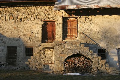
Une ferme aux Roranches, Champsaur - Marc Corail - PNE  Architecture
Champsaur architecture
Today's landscapes and the houses are no accident. They bear the trace of humans, who were less concerned with building attractive places, than with striving to find the best rigorously functional solutions for the area. In the northern part of the Drac valley, an area often faced with a cold wind, hedges were planted, buildings were close together and almost blind on the north-facing side. On the balconies to the east, as in St-Michel-de-Chaillol or St-Julien-en-Chapsaur, the aim was to find sunlight and the facade often had a large porch.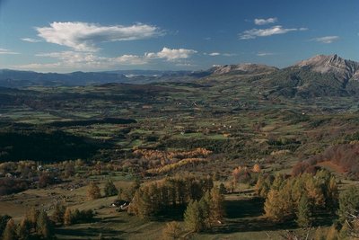
Le bocage du Champsaur, Saint-Michel-de-Chaillol - PNE  Flora
FloraHedging
Hedged landscapes were quite common in France before the war, but here, above an altitude of 1000 m, a wonderful diversity has been maintained. A patchwork of hedgerows, prairies and woods are home to an array of birds. Amongst them are many common sparrows (red-backed shrikes, stonechats, sparrows, quails and wrynecks) whose numbers are in decline in France, sometimes alarmingly so. Richness is therefore not solely due to rarity.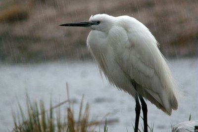
Aigrette garzette - Damien Combrisson - PNE  Fauna
FaunaOrnithologial diversity
Thirty years of careful inventories have identified 220 species of bird in the valley. This exceptional variety is not only due to the landscapes (hedges, wetlands, forests and high mountains) but also to the Champsaur's geographical position: not quite north-alpine, wide open to the south with the Manse and Bayard thresholds, ideal for exchange and for migratory birds such as herons, ducks, red-footed falcons or flycatchers.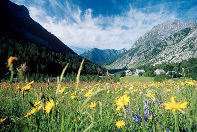
Prairie de fauche dans la vallée de Champoléon - PNE FloraHayfields
When they have not been disturbed by modern fertilisation techniques and silage, around fifty species of plant can still be found in the hayfields. The most symbolic are the poet's daffodil, alpine salsify, meadow sage, sainfoin and globeflower that punctuate the landscape with their different colours.
Altimetric profile
Sensitive areas
Short-toed snake eagle
- Impacted practices:
- Aerial,
- Sensitivity periods:
- MarAprMayJunJulAugSep
- Contact:
- Parc National des Écrins
Julien Charron
julien.charron@ecrins-parcnational.fr
Information desks
House of Champsaur
05260 Pont-du-Fossé
Information and documentation, temporary exhibitions. Sale of products and works of the Park. In the same space, home office Tourist High Champsaur. Free admission. All animations of the Park are free unless otherwise stated.
Tourisme Office of Champsaur & Valgaudemar
Les Barraques, 05500 La Fare en Champsaur
Access and parking
From the N85 head towards Saint Bonnet and follow the D43 then the D143 towards Chaillol or Chaillol 1600.
Parking :
Source

Report a problem or an error
If you have found an error on this page or if you have noticed any problems during your hike, please report them to us here: