1. Tour of Vieux Chaillol - Stage 1 out of 5
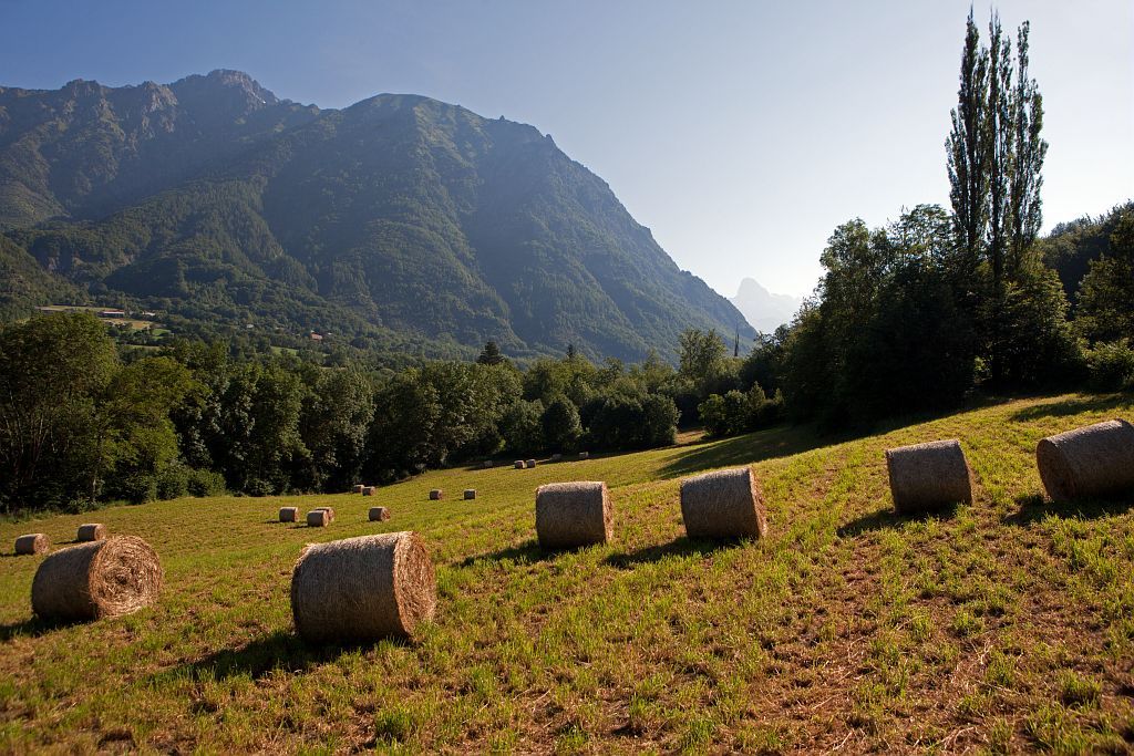
The Valgaudemar area will fascinate you with its alpine character and glacial sites. Although life is sometimes difficult here, it expresses the deep attachment the inhabitants have for their valley. Meeting with them will be enough to persuade you.
Description
- Follow this trail in a north-easterly direction.
- A surfaced road 300 m away leads to Saint-Jacques-en Valgaudemar.
- Leave the road after a fountain, cross the Herbeys canal and follow it for 800 m. An earth trail then a surfaced road (700 m) will take you to Séchier.
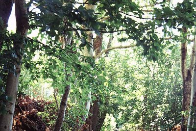
- Carry on up on the right and cross the village until you link up with the canal and follow it along the cool shady banks for 2 km.
- Leave it before La Chaup. Almost directly, at the bottom of the steep slope, cross the Chasserand stream before arriving at l’Ubac.
- After the Prentiq bridge, turn left, then right where a path, bordered by a stone walls leads to the hamlet of Garets. Continue through the hamlet and further on into the undergrowth to link up to the GR54 after the campsite at the Villar-Loubière bridge.
- From there, follow the GR54. At « le Bas Lieu », just before Les Andrieux, continue along the Séveraisse to La Chapelle-en-Valgaudemar.
- Departure : Hameau des Paris, Saint-Jacques-en-Valgaudemar
- Arrival : La Chapelle-en-Valgaudemar
- Towns crossed : Saint-Jacques-en-Valgodemard, Saint-Maurice-en-Valgodemard, Villar-Loubière, and La Chapelle-en-Valgaudemar
2 points of interest
Le canal des Herbeys - Olivier Warluzelle - PNE  Vernacular heritage
Herbeys canal
Inhabitants of Valgaudemar have long tried to control water to compensate for dry summers. The Herbeys canal still functions and is well used. With more than 600 litres per second, it waters 289 ha in the districts of Chauffayer and St-Jacques. It is 28km long and was started and finished on the initiative of François Dupont de Poncharra des Herbeys'. It is maintained every year by the members of the users' union who spend several days cleaning out the canal as well as consolidating the vaults.
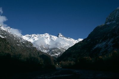
L'Olan et l'entrée de la vallée du Valgaudemar - PNE  Panorama
The Olan 'summits'
The Olan is one of the main summits of the Ecrins massif. It culminates at 3564 m and is made up of three summits the highest of which is the north summit. The central summit of the Olan was climbed for the first time on 8th July 1875, and the northern one on the 29th June 1877 by the renowned W.B.A. Coolidge and his guide Almer. With a guide, or good climbing abilities, this would be a good choice for climbing a summit in the Valgaudemar starting from the Olan hut.
Altimetric profile
Sensitive areas
Peregrine falcon
- Impacted practices:
- Aerial, Vertical
- Sensitivity periods:
- FebMarAprMayJun
- Contact:
- Parc National des Écrins
Julien Charron
julien.charron@ecrins-parcnational.fr
Golden eagle
- Impacted practices:
- Aerial, , Vertical
- Sensitivity periods:
- JanFebMarAprMayJunJulAug
- Contact:
- Parc National des Écrins
Julien Charron
julien.charron@ecrins-parcnational.fr
Short-toed snake eagle
- Impacted practices:
- Aerial,
- Sensitivity periods:
- MarAprMayJunJulAugSep
- Contact:
- Parc National des Écrins
Julien Charron
julien.charron@ecrins-parcnational.fr
Short-toed snake eagle
- Impacted practices:
- Aerial,
- Sensitivity periods:
- MarAprMayJunJulAugSep
- Contact:
- Parc National des Écrins
Julien Charron
julien.charron@ecrins-parcnational.fr
Recommandations
In rainy conditions, it is advised to go to La Chapelle en Valgaudemar by road.

Information desks
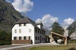
Valgaudemar Park house
Ancien Asile Saint-Paul, 05800 La Chapelle-en-Valgaudemar
Information, documentation and a reception area with permanent and temporary exhibitions. La Maison du Parc is labeled "Tourism and Disability". Free admission. All animations of the Park are free unless otherwise stated.

Tourisme Office of Champsaur & Valgaudemar
Les Barraques, 05500 La Fare en Champsaur
Transport
On the Grenoble-Gap bus route, stop at Saint-Firmin (2 km from Paris)
Access and parking
From the N85, take the D16 towards Lallée where you will follow the D16a and the D316. Take the first road on the right after Entrepierre.
Parking :
More information
Source

Report a problem or an error
If you have found an error on this page or if you have noticed any problems during your hike, please report them to us here: