1. From La Chapelle-en-Valgaudemar to the Refuge des Souffles (start of the GR footpath
Description
- Cross the Séveraisse river and follow its right-hand bank until you reach the Les Andrieux bridge (1,043 m). Take the path on the right to follow the Séveraisse river, now along the left-hand bank.
- At the Séveraisse bridge (1,025 m), cross the river again heading for the hamlet of Villar Loubière (1,033 m). Leave the hamlet via its north end heading for the Stage gîte d'étape « Le Relais de la Vaurze » and the « La Charrière » gîte further on.
- At the Parc des Ecrins signs, follow the road suitable for motor vehicles for a short distance before taking the path on the left. Follow the Le Villar mountain stream as it gradually rises upwards. Cross the Le Lautier stream via a wooden walkway (1,220 m). The path winds upwards, mainly through undergrowth. Turn left at the Pas de Galiane and carry on along the twisting path. At the intersection (1,800 m), take the easy path on the right which leads to the Refuge des Souffles (1,975 m).
- Departure : La Chapelle-en-Valgaudemar
- Arrival : Les Souffles, Villard Loubière
- Towns crossed : La Chapelle-en-Valgaudemar and Villar-Loubière
6 points of interest
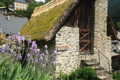
Le moulin de Villar-Loubière - Florence Chalandon ©  History
Villar-Loubière windmill
As you begin the steep climb towards the Col de la Vaurze, don’t miss the unusual Villar windmill, covered in vegetation. Built in 1838, this legacy from past times has been perfectly preserved with its curious horizontal wheel. It was still in use 50 years ago, milling wheat, but also nuts and rapeseed. It was restored in 1979 and is the last working windmill in the Valgaudemar valley.

Les arraches - Olivier Warluzelle - PNE  Geology and geography
Arraches
From the refuge, or during the climb, a peculiar geological formation may catch your eye on the opposite bank, above the old hamlet of Peines. Sedimentary rocks are trapped in the middle of crystalline formations where erosion has created a specific pattern of erosion that looks like a giant tiger has clawed at the rock. This morphology is what gave it the name Arraches.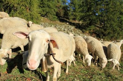
Brebis dans un mélézin - Jean-Philippe Telmon - PNE  Pastoralism
Sheep on the mountain pasture
During your walk, you might come across sheep on the mountain pastures. This is an old form of pastoralism, as proven by the dry stone enclosures that you will see. These are known as 'jas'. You will also notice a rock shelter near to the Clot. The sheep that are in these pastures belong to breeders from the valley or from the Bas Champsaur area.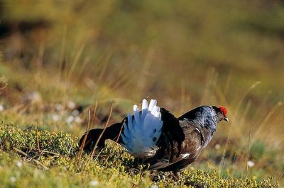
Tétra lyre mâle - Robert Chevalier - PNE  Fauna
FaunaBlack Grouse
The upper limit of the forest is where you are likely to see the black grouse. The female has faith in her bland-coloured feathering that camouflages her in the vegetation, making her difficult to spot. On the other hand, the male, which is black and white with red "eyebrows”, is not so private, particularly during the reproduction season when their cooing and hissing sounds echo in the mountain in the early morning.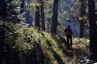
Montée au refuge des Souffles par la forêt de mélèze du Lautier - Bernard Guidoni - PNE  Flora
FloraVariety of the natural environment
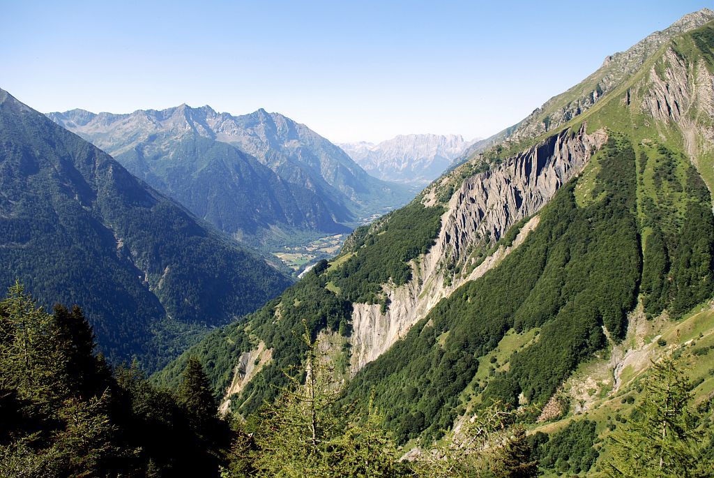
This walk is a summary of south facing slopes in the Valgaudemar area. It starts in the warm scree that it more or less vegetated. It then progresses over lawns and moors of juniper, blueberries or bearberries... They give way to mountain ash, whitebeam and amelanchiers indicating that the forest will soon take over. Higher up, the beech forest casts shade on the walkers, next a beautiful larch forest is a sign that the forest environment will give way to the high altitude moors and lawns. The Lautier lake and the surrounding ponds are a haven for aquatic species. Still higher, is the realm of rocks and chamois.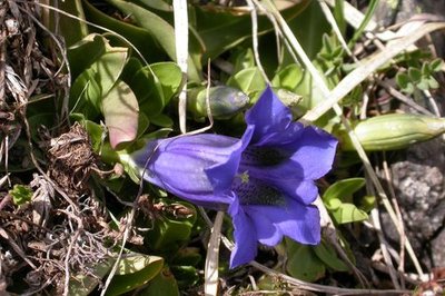
Gentiane - Olivier Warluzelle - PNE FloraVariety of plant life
There is a large variety of plant life along the itinerary, particularly on the slopes above the refuge, due to the exposure, the soil types and the altitude. Marjoram, lis, laserwort, houseleek, stinecrop, gentian, columbine, aconite and many others are present.
Altimetric profile
Sensitive areas
Short-toed snake eagle
- Impacted practices:
- Aerial,
- Sensitivity periods:
- MarAprMayJunJulAugSep
- Contact:
- Parc National des Écrins
Julien Charron
julien.charron@ecrins-parcnational.fr
Recommandations
Parking spaces are available along the departmental road at La Chapelle en Valgaudemar, near the National Park Centre. The Park Centre car park is for staff only!
For the most hardened walkers, it is possible to combine this stage with the next day's stage, and reach Le Désert en Valjouffrey via the Vaurze pass in 9½ hours.

Information desks
Valgaudemar Park house
Ancien Asile Saint-Paul, 05800 La Chapelle-en-Valgaudemar
Information, documentation and a reception area with permanent and temporary exhibitions. La Maison du Parc is labeled "Tourism and Disability". Free admission. All animations of the Park are free unless otherwise stated.
Transport
Bus line Gap-Grenoble, Saint-Firmin bus stop : https://www.itinisere.fr/ or https://carsisere.auvergnerhonealpes.fr/
From here, possibility of taking a summer shuttle to La Chapelle. The shuttle can be booked in advance via the ticket office on the Champsaur Valgaudemar tourist office website: https://www.champsaur-valgaudemar.com/offres/navette-du-valgaudemar-saint-firmin-fr-2301984/m/ .
Access and parking
Parking :
Source

Report a problem or an error
If you have found an error on this page or if you have noticed any problems during your hike, please report them to us here: