GR®54 - Tour of L'Oisans and Les Écrins starting from La Chapelle-en-Valgaudemar
Embarking on one of the most difficult GR® routes in France, a challenge for experienced hikers. On the route: 14 passes, elevation changes of almost 12,000 metres and 190 kilometres to cover in 12 days in the majestic Massif des Écrins. Leave the beaten path behind and enjoy a variety of breathtaking landscapes along variants of the GR®54, over three Stages of the circuit.
Important information
Dans le Parc national des Écrins, les sentiers sont généralement praticables de la mi-juin à fin septembre.
Toutefois, les périodes d'accessibilité des itinéraires et les dates de pose des passerelles varient d’une année à l’autre en fonction de l’enneigement, des dégâts survenus en hiver et des conditions météorologiques.
Par ailleurs, l’état des sentiers n’est pas contrôlé quotidiennement et peut évoluer rapidement après un évènement météorologique (orage, crue...). Il est nécessaire de se renseigner auprès des maisons du parc national et des offices de tourisme du territoire avant votre sortie.
Pendant la randonnée, en cas de passage dégradé ou dangereux, faites demi-tour et signalez-le.
12 steps
Description
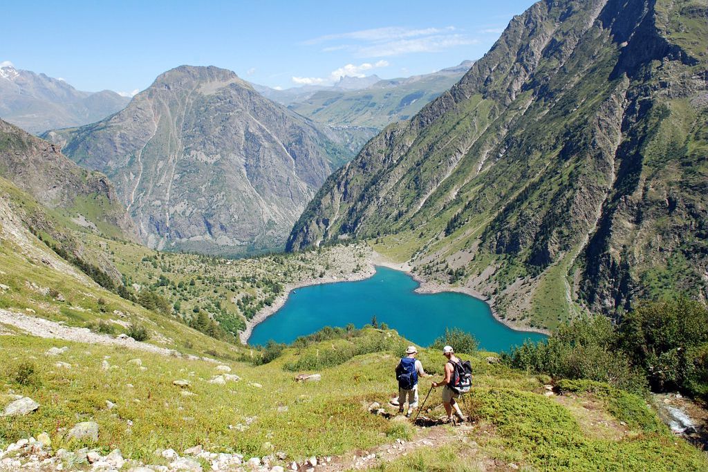
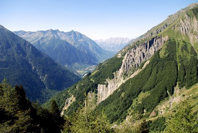
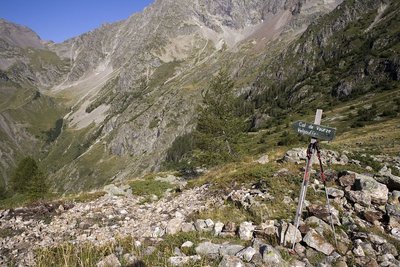
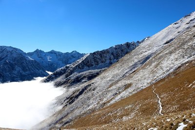
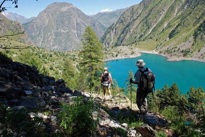
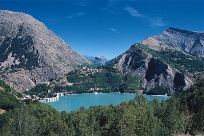
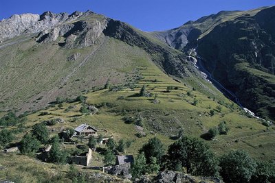
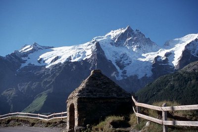
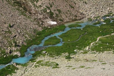
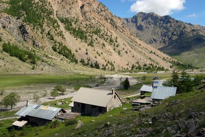
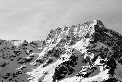
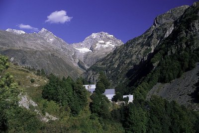
Starting from La Chapelle-en-Valgaudemar, the Tour of L'Oisans and Les Écrins begins gently along the Séveraisse river before striding up the southern slope of the Pic des Souffles which offers an unrivalled view of the Valgaudemar valley. The next day's Stage consists in crossing the impressive Col de la Vaurze. Equally impressive is the descent down into the wild Valjouffrey. The verdant Col de Côte Belle leads to the village of Valsenestre in the Béranger valley. Take a restorative break at the end of this Stage before setting off again on variant B of the GR®54, which is the longest stage of the route in terms of time and one of the most difficult due to its significant elevation changes. Via the Col de la Romeïou, the variant takes you past numerous lakes, one of which is the most iconic on the Oisans side of Les Écrins: Lac du Lauvitel (1,530 m altitude). The next stage then takes you close to the famous Les Deux Alpes winter sports resort on both slopes (Vénosc and Mont-de-Lans) linked by variant C of the GR®54, and comes to the pretty village of Mizoen. The path continues, rising in altitude up the mountain side and shadowing the shore of the large Lac du Chambon below, before it reaches the refuges at the foot of the Emparis plateau. Above, the Col de Souchet offers a five-star view over La Meije. A descent of almost 1,000 metres brings you to La Grave. Here, you have to follow the Romanche river until you reach its source on the alpine pasture of Villar d'Arène. When you reach the Col d’Arsine, the scene is stunning. The surrounding realm of high peaks invites a visit to the glacial Lacs d’Arsine before embarking on a long descent following the mountain stream Le Petit Tabuc, down to the valley of La Guisane and Monêtier-les-Bains. Objective: La Vallouise via the Col de l’Eychauda and the tranquil chalets of Chambrain. Eight kilometres of motor road following the mountain stream L'Onde brings you to the alpine pastures of Jas Lacroix. Crossing the Col de l'Aup Martin, the highest pass on the route, is always a high point of the adventure, and the descent to the Pré de la Chaumette is equally exhilarating. To reach Lac de Vallonpierre, no fewer than three passes cut through the shale have to be negotiated with care. The last stage consists of a long descent into the valley of Valgaudemar where the path comes to La Chapelle en Valgaudemar, the culmination of the GR®.
- Departure : The Park Centre ("Maison du Parc") in La Chapelle-en-Valgaudemar
- Towns crossed : La Chapelle-en-Valgaudemar, Villar-Loubière, Valjouffrey, Le Périer, Le Bourg-d'Oisans, Les Deux Alpes, Mizoën, La Grave, Villar-d'Arêne, Le Monêtier-les-Bains, Vallouise-Pelvoux, L'Argentière-la-Bessée, and Champoléon
Altimetric profile
Recommandations
The best period for undertaking this tour is from late June to mid-September.
Find out about weather and snow conditions on the passes in early summer.
Some stretches, in the upper reaches of the mountains, pass through tricky terrain.
It is possible to bivouac along the GR route (see the regulations for the heart of the National Park) or to overnight at campsites, hotels, gîtes or refuges.
The Stages require that you carry your own food.

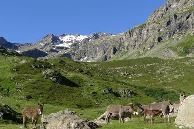
 In mountain pastures, protection dogs are there to protect the herds from predators (wolves, etc.).
When I hike I adapt my behavior by going around the herd and pausing for the dog to identify me.
Find out more about the actions to adopt with the article "Protection dogs: a context and actions to adopt".
Tell us about your meeting by answering this survey.
Information desks
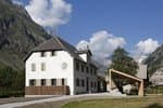
Valgaudemar Park house
Ancien Asile Saint-Paul, 05800 La Chapelle-en-Valgaudemar
Information, documentation and a reception area with permanent and temporary exhibitions. La Maison du Parc is labeled "Tourism and Disability". Free admission. All animations of the Park are free unless otherwise stated.
Transport
From Gap and Grenoble:
Bus line Gap-Grenoble, Saint-Firmin bus stop : https://www.itinisere.fr/ or https://carsisere.auvergnerhonealpes.fr/
From here, possibility of taking a summer shuttle to La Chapelle. The shuttle can be booked in advance via the ticket office on the Champsaur Valgaudemar tourist office website: https://www.champsaur-valgaudemar.com/offres/navette-du-valgaudemar-saint-firmin-fr-2301984/m/ .
Access and parking
On the N85, after the Les Richards bridge, turn right onto the D985a (towards Saint Firmin). La Chapelle is approximately 18 km from this crossroads.
Parking :
More information
Source

Report a problem or an error
If you have found an error on this page or if you have noticed any problems during your hike, please report them to us here: