From Pré de la Chaumette to Lake Vallonpierre (stage of the GR 54)
Champoléon Hard
Hard
7. From Pré de la Chaumette to Lake Vallonpierre (stage of the GR 54)
6h
10,9km
+1162m
-706m
Stage
Embed this item to access it offline
We have hardly reached the Champsaur before hikers already have the chance to explore other valleys. Today it's the turn of the Valgaudemar, but with the aim of reaching the lake and the refuge.
Description
From the Pré de la Chaumette refuge (1 790 m), walk up the Pierre valley, then follow the meandering footpath that rises over the south-west slopes of the Sirac. After following the panoramic route, walk up the Vallette valley as far as the mountain pass of the same name (2 668 m).
- Go over the pass and walk down the schist slopes, then cross the wide grassy Gouiran valley. Walk up as far as the Col de Gouiran (2 597 m)
- Then descend the Plat valley. The footpath is at times rudimentary, but the next mountain pass is clearly visible. Go up the schist slopes as far as the narrow Col de Vallonpierre (2 607 m).
- You arrive at the bottom of the cirque along steep schist slopes reaching down to the lake (2 271 m) in a grassy landscape scattered with large rocks. It is in these peaceful surroundings that you will spend the night!
- Departure : Le Pré de la Chaumette, Champoléon
- Arrival : Lake Vallonpierre, La Chapelle-en-Valgaudemar
- Towns crossed : Champoléon and La Chapelle-en-Valgaudemar
2 points of interest
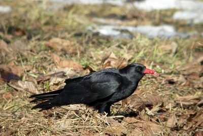
Crave à bec rouge - Damien Combrisson - PNE  Fauna
FaunaRed-billed chough
The red-billed chough is in many ways a surprising bird. It lives near cliffs and plays among the clouds, breaking the silence with a brief, strident, almost metallic cry. Hearing the echo from the cliff walls, its companions reply. With its confident gait and regular step, the red-billed chough patrols the Alpine pastures in small groups, meticulously searching for small worms and meadow grasshoppers. Apart from a few brief seasonal excursions in search of available food, the chough is a sedentary bird.
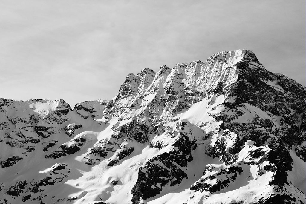
Le Sirac depuis Vallonpierre - Mireille Coulon - PNE  Top
TopThe Sirac
To the south of the Ecrins mountains, the Sirac is the last major summit at 3441 m. It stands proudly at the end of the Séveraisse valley. Often during the hike, you will lift your head in wonder and greet this noble lord with its crown. You will walk at its foot and see its hanging glaciers above you. It’s magic!
Altimetric profile
Recommandations
The path crosses schist slopes that can prove extremely slippery, particularly when it is raining.
If the three mountain passes are covered in snow or inaccessible, it is possible to reach the GR54 in Villar Loubière in three days via the local GR trail, the "Tour du vieux Chaillol".
Is in the midst of the park
The national park is an unrestricted natural area but subjected to regulations which must be known by all visitors.

Source

Parc national des Ecrinshttps://www.ecrins-parcnational.fr
Report a problem or an error
If you have found an error on this page or if you have noticed any problems during your hike, please report them to us here: