
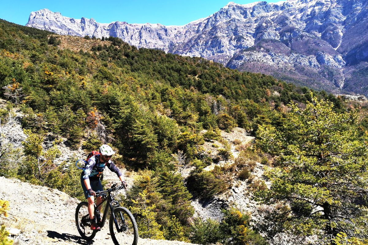
2. From Savines-le-Lac to Le Lauzet-Ubaye
 Hard
HardImportant information
Dans le Parc national des Écrins, les sentiers sont généralement praticables de la mi-juin à fin septembre.
Toutefois, les périodes d'accessibilité des itinéraires et les dates de pose des passerelles varient d’une année à l’autre en fonction de l’enneigement, des dégâts survenus en hiver et des conditions météorologiques.
Par ailleurs, l’état des sentiers n’est pas contrôlé quotidiennement et peut évoluer rapidement après un évènement météorologique (orage, crue...). Il est nécessaire de se renseigner auprès des maisons du parc national et des offices de tourisme du territoire avant votre sortie.
Pendant la randonnée, en cas de passage dégradé ou dangereux, faites demi-tour et signalez-le.
Description
- Go past Pierre-Arnoux. At 100 metres, turn left and then climb up the track on the right (DFC1 H1). After the picnic area, leave the track and climb up the path on the left. Stay on the main path which is clearly signposted.
- After the steep rise (pushing), take the steep trail on the right. Stay on the main trail until you come to the water catchment. Head downhill (poorly marked path), cross the clearing to take a path on the left. At the four-track instersection, turn left. Stay on this path which cuts several times across skid tracks.
- After the mountain stream which runs under the path, take the path on the left which runs uphill (pushing). At Le Chauchais, turn right and right again and then head straight on downhill until you come to the Pontis road.
- At the Pontis road, head left up the D7 until you come to the Col de Pontis road mender's hut ("Cabane du Cantonnier "). At the hut, head left up the road. Stay on the main balcony track, heading towards Le Morgonnet. Go past the Chapelle Saint-Pierre (downhill from it) and above the hamlet of Les Hugues.
- 500 metres after the spring, plunge right onto the Pinet trail and, after the dry stone wall, take the hairpin path on the right. The descent is strewn with stones and becomes technical (take care).
- Above the hamlet of Le Villard, carry straight on along the regional GR ("GR de Pays"). (Access to the dolmen is on the right). At 100 metres, between the low walls, head downhill on the trail on the right. In the pasture, follow the cliff edge and then through the fence, (/!\ Feet on the ground required for 50 metres on the steep descent). Before the "wall", leave the GR by going downhill to your right until you come to the hamlet of Les Vallettes.
- At the ruins of Les Valettes, turn left and then, at the second ruin, follow the hairpin trail right along the mountainside.
- At the bend in the path, head right uphill for 250 metres before plunging left onto a trail (presence of a small cairn). Go down the ravine of Les Blaches, always keeping to the downhill option, until you come to the Ubaye cemetery.
- At the Ubaye cemetery, take the lakeside road on the left (D954), go past the first tunnel and the chain-up area before taking a left into the tunnel, along the trackbed of an unfinished railway line. Continue along the main track until you reach Le Lauzet.
- Towns crossed : Savines-le-Lac, Pontis, and Le Lauzet-Ubaye
2 points of interest
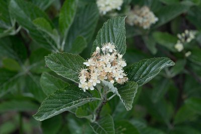
Alisier Blanc - Mireille Coulon - PNE  Flora
FloraWhite Birch
This is a beautiful tree that can reach 15 m in height. Its leaves can be identified by the white tomentose down on the underside. Its white flowers are grouped together in an inflorescence and bud fruit called "alises", which appear at the end of summer. This species likes a lot of light and tolerates dry conditions well. It can be found in open woods and on sunny, even rocky, dry slopes in the mountains.
.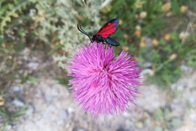
Zygène de la bugrane - Amélie Vallier  Fauna
FaunaZygaena hilaris
This is a medium-sized butterfly (25-35 mm wingspan), often brightly coloured, with up to six spots on the inner wing. This Burnet is found on the edges of limestone meadows, steppe-like slopes, dry shrublands and clearings in dry forests. This remarkable species is indicative of the quality of the habitats. It is not nevertheless endangered, which is why it is not on the list of threatened species.
Altimetric profile
Recommandations
The lake at Le Lauzet and its terrace... are very welcome after a day's pedalling!
Source

Report a problem or an error
If you have found an error on this page or if you have noticed any problems during your hike, please report them to us here: