From Les Marrons to Orcières (Chauffarel)
Saint-Michel-de-Chaillol Medium
2. From Les Marrons to Orcières (Chauffarel)
6h30
19,4km
+688m
-874m
Stage
Embed this item to access it offline
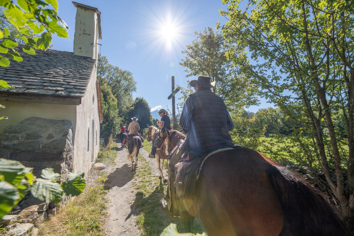
From precipitous paths to forest tracks, you pass through a succession of varied landscapes. From the vast belvederes of the Plateau de la Coche to high alpine pastures, remarkable rocky landscapes and the peaks of the Champsaur, you have the privilege of scenic vantage points offering plunging views over the valleys and wild banks of the Drac Blanc until you arrive at the Orcières leisure base.
Description
Leaving Les Marrons, follow the Riou uphill (north-east) and, at the shed, fork right towards Famourou along a wooded footpath. It leads to a grassy track which you join left. At Forest de Famourou, the path reaches a wider track: continue left towards Les Roranches. A magnificent view emerges over the Aiguilles de Famourou and Le Palastre. At Le Coulet and then at Le Vernet, where you go through two wooden cow pen gates, always follow signs for Les Roranches.
- In Les Roranches, take the time to admire the chapel of Saint-Pancrace, the oratory and the former school, among other things. Before the bread oven, descend down to L'Horte via shortcuts signposted "Pied du Palastre" and climb uphill again via Les Bonnets and Les Jalligons until you reach La Baumette. Then continue straight ahead on the track heading towards Les Richards on the GR50. Ford across the Brudou (shaky footbridge) and then carry on along the GR route which comes out at Les Richards.
As you enter the hamlet take care: there is an overhead cable then three steps and a gate!
Go through Les Richards, noting the fine oven. - Continue to head towards La Coche (mountain biking ("VTT") route). When you leave La Coche, continue straight on towards the visitor area ("Aire d'Accueil") and the plateau (picnicking or bivouacking possible).
- Fork left onto the PR (Petite Randonnée, short-distance trail), just after the car park.
- At Le Robinet, fork right towards Champoléon along a fine grassy and flat track. This changes into a narrow winding footpath which drops down through the woods to Les Aryiés and Les Rolands.
- When you come to Le Pied des Vignes, turn right and cross the Pont des Eyrauds and turn right onto the D944 road. In its recess on the right, take the track that extends it along the GR50; now follow the Drac Noir and go past the Gîte de Chauffarel until you come to the Orcières leisure base, straight ahead.
- Towns crossed : Saint-Michel-de-Chaillol, Saint-Jean-Saint-Nicolas, Champoléon, and Orcières
1 point of interest

 Vernacular heritage
Les Richards
Perched up at an altitude of 1548 m above Pont-du-Fossé in the commune of Saint-Jean-Saint-Nicolas, the village of Les Richards is a haven of tranquillity. The view is breathtaking over the Autanes and the Champsaur woodlands. This is the starting point for a very popular hiking trail around the mountains or to the summit of the Palastre, and a take-off area for long-distance hang-gliders. It is not unusual for a hang-glider to land in Grenoble and sometimes even in Chamonix after a long day's flight from Les Richards! The record is 162 km, with a landing in Chamonix in 2002.
Altimetric profile
Sensitive areas
Along your trek, you will go through sensitive areas related to the presence of a specific species or environment. In these areas, an appropriate behaviour allows to contribute to their preservation. For detailed information, specific forms are accessible for each area.
Golden eagle
- Impacted practices:
- Aerial, , Vertical
- Sensitivity periods:
- JanFebMarAprMayJunJulAug
- Contact:
- Parc National des Écrins
Julien Charron
julien.charron@ecrins-parcnational.fr
Peregrine falcon
- Impacted practices:
- Aerial, Vertical
- Sensitivity periods:
- FebMarAprMayJun
- Contact:
- Parc National des Écrins
Julien Charron
julien.charron@ecrins-parcnational.fr
Report a problem or an error
If you have found an error on this page or if you have noticed any problems during your hike, please report them to us here: