
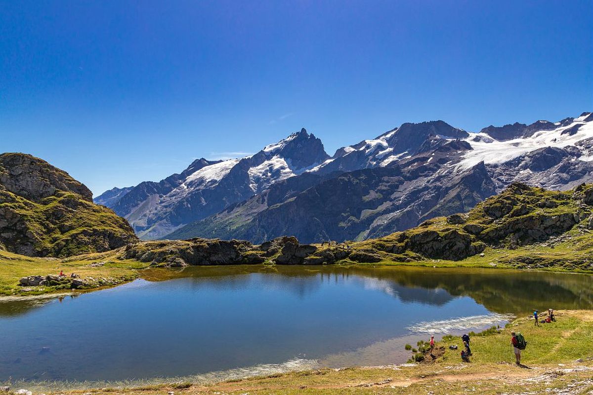
2. From Les Clots refuge to the Pic du Mas de la Grave refuge
 Hard
HardImportant information
Dans le Parc national des Écrins, les sentiers sont généralement praticables de la mi-juin à fin septembre.
Toutefois, les périodes d'accessibilité des itinéraires et les dates de pose des passerelles varient d’une année à l’autre en fonction de l’enneigement, des dégâts survenus en hiver et des conditions météorologiques.
Par ailleurs, l’état des sentiers n’est pas contrôlé quotidiennement et peut évoluer rapidement après un évènement météorologique (orage, crue...). Il est nécessaire de se renseigner auprès des maisons du parc national et des offices de tourisme du territoire avant votre sortie.
Pendant la randonnée, en cas de passage dégradé ou dangereux, faites demi-tour et signalez-le.
Description
- Take the footpath on the right (GR54). Follow the first footpath on the right (off the GR) which leads to Lac Noir and Lac Lerié. Poorly marked initially, the path first takes you to the small crystalline lake across bouldery terrain. Continue uphill until you reach a flat area, ignoring the path leading off to the left, and you come to the shores of Lac Noir. Carry straight on due east until you come to Lac Lerié.
- At the next intersection, ignore the right-hand path to rejoin the GR54 downhill from the Col du Souchet. You reach it by climbing up to your left.
- Leave the GR54, heading right into the alpine pasture to join a well-worn footpath and a first marker bearing a red waymark. The narrow footpath runs along the mountainside and is marked out by posts bearing the red waymark. The footpath drops down gently and crosses two small streams. At the next marker, take careful note of the waymarks, take a right-angle turn to the left towards the "Col de la Berche", following the metal poles. From the Col de la Berche, go down the zig-zagging footpath which leads to the Buffe valley.
- You come to a split in the path at a cairn. Ignore the path running downhill to the right and carry straight on. Running between small hillocks, the stony footpath is faint. Use the occasional cairns to find your way.
- Further on, fork right. The route winds down through the alpine pasture, passing close to some ruins and running through a few small streams. The path widens and takes the form of a track. When you reach a marker, follow the "Refuge" sign.
- When you come to an intersection with a very clear earth track, follow it to the left heading towards the valley bottom (Les Combettes).
- Turn right before the mountain stream and follow the steeply sloping track and cross the footbridge.
- Turn immediately left, heading back up towards the valley bottom, and then immediately right after the next mountain stream towards the Pic du Mas refuge.
- Towns crossed : Mizoën and La Grave
Altimetric profile
Sensitive areas
Bearded vulture
- Impacted practices:
- Aerial, , Vertical
- Sensitivity periods:
- JanFebMarAprMayJunJulAugNovDec
- Contact:
Parc National des Ecrins - Yoann Bunz- 06 99 77 37 65 yoann.bunz@ecrins-parcnational.fr
Bearded vulture
- Impacted practices:
- Aerial, , Vertical
- Sensitivity periods:
- JanFebMarAprMayJunJulAugNovDec
- Contact:
Golden eagle
- Impacted practices:
- Aerial, , Vertical
- Sensitivity periods:
- JanFebMarAprMayJunJulAug
- Contact:
- Parc National des Écrins
Julien Charron
julien.charron@ecrins-parcnational.fr
Information desks
Tourist information office of La Grave
RD1091, 05320 La Grave
Opening hours:
- May to mid-June: from Tuesday to Saturday from 9 am to noon and from 2 pm to 5 pm.
- Mid-June to mid-July and mid-August to mid-September: Monday to Saturday from 9 am to noon and from 2 pm to 5.30 pm.
- Mid-July to mid-August: every day from 9 am to noon and from 2 pm to 5.30 pm.
Oisans Park house
45 avenue de la République, 38520 Le Bourg d'Oisans
Video presentation of the natural resources of the Oisans mountain and its crafts. Information, documentation about the Park, projections, reading space for children. Accessible to people with reduced mobility. Free admission. All animations of the Park are free unless otherwise stated.
More information


Source

Report a problem or an error
If you have found an error on this page or if you have noticed any problems during your hike, please report them to us here: