5. From Charbillac to Les Payas
A stage offering the added benefit of artistic, historical and heritage visits and tranquil breaks in a forest setting surrounded by mountains.
Description
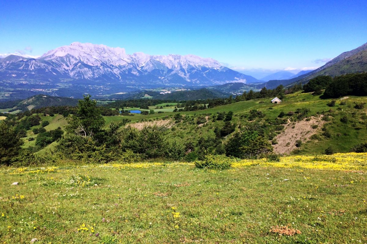
- At "Pré Braqs", continue straight ahead on the track heading towards the Lac de Barbeyroux. At the track intersection in a clearing, turn right onto the PR (mountain biking ("VTT") waysigns). A panoramic view over the lakes and hedged farmlands of the Champsaur emerges into sight.
- At "Reviraou", do not go through the gate to a cow enclosure but go downhill to the right, to the meadow (arrow painted on a stone on the ground), following the fence line until you reach the marked PR path. Go around the lake.
- Take the drivable track which runs downhill to the left, called "Béal de Fonteniou". At La Blache, continue right along the main road, towards Les Payas.
- Departure : Charbillac
- Arrival : Les Payas
- Towns crossed : Bénévent-et-Charbillac, La Motte-en-Champsaur, Les Infournas, and Saint-Bonnet-en-Champsaur
3 points of interest
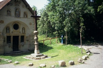
La chapelle des Pétêtes - Hervé Cortot - PNE  History
Petetes Chapel
This chapel is an oddity as well as a remarkable piece of popular art. Here the "pepetes" are dolls! The story says that in 1730, a shepherd named Pascal, who also happened to be a mason, started chipping rocks. All winter he chipped away at the rocks. When he had chiselled enough, he dug the ground and placed the stones on top of each other. When he finished, the hamlet of Aubérie had a pretty, little mountain chapel. The mysterious shepherd had created small alcoves in the chapel's facade. He started chiselling again, but this time with greater precision and love, as he was sculpting statues. In 1741, after working 11 years, he finished his work of art and placed a monumental cross in front of the chapel.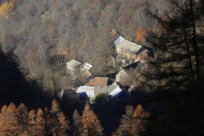
Les Infournas Hauts - Parc national des Écrins - Marc Corail  Geology and geography
Les Infournas
The locality is made up of two hamlets:
- Les Infournas-Bas, former administrative seat of the municipality, with the mayor's office and the church, standing at 1,245 metres above sea level.
- Les Infournas-Hauts, a starting point for mountain hiking, which stands at 1,373 metres above sea level.
It is only possible to access the Drac valley, a lifeline for the region, via two winding roads, one to the north-west towards Chauffayer 10 km away, the other to the south towards Saint-Bonnet-en-Champsaur which is 7 km away. Most of the territory is made up of the inhospitable and extensively ravined slopes of the mountains Le Cuchon and Le Queyron. To the south, woods constitute its only real resource.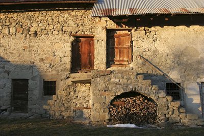
Une ferme aux Roranches, Champsaur - Marc Corail - PNE  Architecture
Champsaur architecture
Today's landscapes and the houses are no accident. They bear the trace of humans, who were less concerned with building attractive places, than with striving to find the best rigorously functional solutions for the area. In the northern part of the Drac valley, an area often faced with a cold wind, hedges were planted, buildings were close together and almost blind on the north-facing side. On the balconies to the east, as in St-Michel-de-Chaillol or St-Julien-en-Chapsaur, the aim was to find sunlight and the facade often had a large porch.
Altimetric profile
Sensitive areas
Short-toed snake eagle
- Impacted practices:
- Aerial,
- Sensitivity periods:
- MarAprMayJunJulAugSep
- Contact:
- Parc National des Écrins
Julien Charron
julien.charron@ecrins-parcnational.fr
Recommandations
Retrace your steps, going due north along the Rue du Frisa then turn left onto the Chemin de Champ Chevril. After the stream in Pisançon, turn right towards the Château Robert. Cross the first road you come to and then turn left onto the D23. Take the first track on the right running uphill to Charbillac.
Lac de Barbeyroux: watch out for fencing wires and posts which can be hidden in the tall vegetation!
At the Maison Forestière de Soubeyranne: Take the time to admire this enchanting location, perfect for a picnic under Le Barry. It offers a table, benches, water fountain, grass, shade, shelter and views of the Col du Noyer and the Faraut mountain.
At the lake, a manmade pool, a lovely space has been laid out for picnicking: table, bench, trees, grass and WC. But watch out for any fencing wires and posts which may have been left in the tall vegetation!
For those on horseback, the stage can be followed to the Centre Équestre Le Rocher equestrian centre, for the horses, and riders can find accommodation at the Gîte Le Rocher in Les Payas (to the right on the road) or at the self-catering Gîte Les Barbeyroux, or at the "Comme un Écrin" guest house located below the equestrian centre.
The stage can also be followed to the La Combe Fleurie guest rooms, just as you enter St Bonnet (Rue de Chaillol, Champ Magnane district, accommodates horses and riders). To get there, go through Les Pelloux and Les Aliberts (see the next route guide). When you come to the D43, turn right and continue straight on for 500 metres (caution: fast-moving traffic).
Report a problem or an error
If you have found an error on this page or if you have noticed any problems during your hike, please report them to us here: