4. From Les Barangeards to Charbillac
Wend you way to the village of Saint-Jacques-en-Valgodemar in the coolness and silence of the Canal des Herbeys. The view then opens out onto the Faraut mountain and the hamlets below. A short break at the Lac de Roaffan before carrying on along the balcony trail overlooking the valley until you reach La Motte-en-Champsaur, nestling amidst the fields. A final climb brings you near to Charbillac.
Description
- On a bend at the Le Comas crossroads, go up to your left towards the Lac de Roaffan, until you reach Le Comas. Here, turn right onto a narrow, level path offering an unobstructed view over Saint-Firmin. At the Entrepierres crossroads, continue to follow the GR50 which rises uphill to the left, and then do the same thing at the Font Salée crossroads: a wooden sign indicates the direction of the lake. This track alternates between grass and stone pavement as it runs along the edge of the meadows. At Les Blachus, continue straight on (GR50) and then, finally, after a wide left- hand bend the GR route leads to the shore of the Lac de Roaffan (bathing prohibited), an ideal place for a break.
- Then carry on towards Les Costes. The waysigned GR and PR (Petite Randonnée, short-distance trail) track becomes flat and grassy. (The Brèche de Faraud and the Col du Noyer are on your right). It comes out onto a road; turn left towards La Motte- en-Champsaur. After the hamlet of Maisseret, the GR leaves the road and drops down to the right along a gravel track, then a grassy path on the left before the farm shed. The path leads back to the road. At the Le Brusq crossroads, continue to follow the GR50 straight ahead and, on the bend at Les Courts, carry straight on again along the track that rises uphill through the wood. There is a clearing as you cross the Col du Collet: continue to follow the GR50 which drops down to the hamlet of Le Collet. Carry on along the road until you are approaching La Motte-en-Champsaur; here, take a shortcut: alternating tracks and roads on the right.
- At the bottom, turn left onto the road (D123) towards Charbillac, then turn right after the Séveraissette mountain stream, on the Les Pascaux bend. Continue straight ahead, passing the water treatment plant to your left. The track crosses the mountain stream without difficulty and the path then climbs steeply through the wood to a flat, easy track leading to a guest house, "Les Cairns".
- Departure : Les Barangeards
- Arrival : Charbillac
- Towns crossed : Saint-Maurice-en-Valgodemard, Saint-Jacques-en-Valgodemard, Chauffayer, Les Costes, La Motte-en-Champsaur, and Bénévent-et-Charbillac
4 points of interest
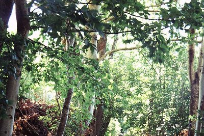
Le canal des Herbeys - Olivier Warluzelle - PNE  Vernacular heritage
Herbeys canal
Inhabitants of Valgaudemar have long tried to control water to compensate for dry summers. The Herbeys canal still functions and is well used. With more than 600 litres per second, it waters 289 ha in the districts of Chauffayer and St-Jacques. It is 28km long and was started and finished on the initiative of François Dupont de Poncharra des Herbeys'. It is maintained every year by the members of the users' union who spend several days cleaning out the canal as well as consolidating the vaults.
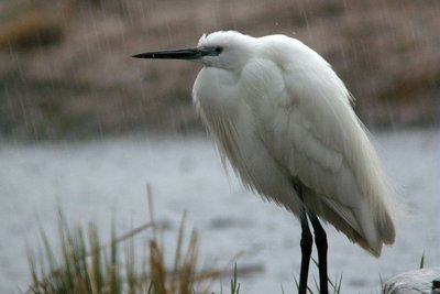
Aigrette garzette - Damien Combrisson - PNE  Fauna
FaunaOrnithologial diversity
Thirty years of careful inventories have identified 220 species of bird in the valley. This exceptional variety is not only due to the landscapes (hedges, wetlands, forests and high mountains) but also to the Champsaur's geographical position: not quite north-alpine, wide open to the south with the Manse and Bayard thresholds, ideal for exchange and for migratory birds such as herons, ducks, red-footed falcons or flycatchers.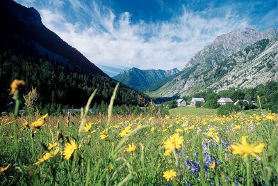
Prairie de fauche dans la vallée de Champoléon - PNE  Flora
FloraHayfields
When they have not been disturbed by modern fertilisation techniques and silage, around fifty species of plant can still be found in the hayfields. The most symbolic are the poet's daffodil, alpine salsify, meadow sage, sainfoin and globeflower that punctuate the landscape with their different colours.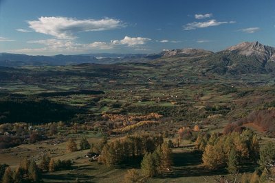
Le bocage du Champsaur, Saint-Michel-de-Chaillol - PNE FloraHedging
Hedged landscapes were quite common in France before the war, but here, above an altitude of 1000 m, a wonderful diversity has been maintained. A patchwork of hedgerows, prairies and woods are home to an array of birds. Amongst them are many common sparrows (red-backed shrikes, stonechats, sparrows, quails and wrynecks) whose numbers are in decline in France, sometimes alarmingly so. Richness is therefore not solely due to rarity.
Altimetric profile
Sensitive areas
Peregrine falcon
- Impacted practices:
- Aerial, Vertical
- Sensitivity periods:
- FebMarAprMayJun
- Contact:
- Parc National des Écrins
Julien Charron
julien.charron@ecrins-parcnational.fr
Golden eagle
- Impacted practices:
- Aerial, , Vertical
- Sensitivity periods:
- JanFebMarAprMayJunJulAug
- Contact:
- Parc National des Écrins
Julien Charron
julien.charron@ecrins-parcnational.fr
Short-toed snake eagle
- Impacted practices:
- Aerial,
- Sensitivity periods:
- MarAprMayJunJulAugSep
- Contact:
- Parc National des Écrins
Julien Charron
julien.charron@ecrins-parcnational.fr
Recommandations
At the Canal des Herbeys, there is an area of rockfall at a tunnel: proceed with caution. At Le Comas, there is a narrow stretch reinforced with logs: proceed with caution.
Brusq: its French name evoking a beehive nestling in a hollow tree.
At La Motte-en-Champsaur: the birthplace of the Venerable JH Gondre, vegetables.
It is also possible to overnight in Pisançon, at the gîte L'Aventure: go down the main road in Charbillac, take the track on the right and then turn first left and carry on until you reach the D23. Turn left and then, at the junction, head downhill towards Pisançon. Turn left onto the Chemin de Champ Chevril, and then right onto the Rue du Frisa.
Report a problem or an error
If you have found an error on this page or if you have noticed any problems during your hike, please report them to us here: