1. From Gap Bayard to Claret
As you wind uphill, beautiful views of the Gap basin and the surrounding peaks open up. Then, you enter the forest in which there are occasional gaps offering a glimpse of the Champsaur area criss-crossed by trees and hedgerows or over the Vieux Chaillol mountain. Further on, at Notre-Dame de Bois Vert or the Chapel of St Etienne, a more cultural break awaits although the panoramic view is no less remarkable.
Description
- Leave the sports trail and head down towards and cross the N85. Follow it southwards for 100m.
- Taking the first route at right, the "route de la Mémoire". Take the 1st turning on the right. Branch off in the direction of Sérigues and Brunets on a road/trail that winding uphill towards the gîte. Enjoy the view of the Gapençais basin, the Tête de Clappe, the Chapeau de Napoléon, the Puy de Manse, the Piolit, the Aiguilles de Chabrière, the Saint-Mens hill, the Avance with Mont Colombis and the peaks of the Ecrins massif.
- Take a forest track, the Route Forestières des Brunets (D54 track), until you reach the Col de Gleize (lying between the peaks of Courmian and Gleize).
- Then on the wide, flat and grassy PR to the right of the Cabane de Folletière, heading towards Notre- Dame de Bois Vert, under the Pic de l'Aiguille. The track joins the Route Forestière de Lauzon forest road among the larch trees. As you head towards the resort of Laye, enjoy the view over the plateau of Bayard, the criss-cross landscape of Champsaur and the Vieux Chaillol mountain. Continue straight on towards La Cuque.
- The route leads straight ahead, passing through Le Clot des Fascines, Le Devès, Sagnassou, Les Croussières, Les Selliers and Les Farelles.
- Before leaving the hamlet of Les Farelles, take the track on the left, running through woods to Notre-Dame de Bois Vert.
- Then, carry on along the forest road of Pignalet, in the Grand Bois de Poligny (take care at the two cattle grids (which you can avoid)). The route leads past Pignalet, Les Pins, Les Bruyères, Preyts et Bouillons and Le Fournache (the Faraud mountain and its characteristic gap can be glimpsed between the trees). Join the road at La Croix. Here, turn left and carry straight on until you reach the Chapel of Saint Étienne.
- Finally, carry on along the road until you come to Le Noyer, where you will find the house where Dominique Villars was born.
- Departure : Gap Bayard
- Arrival : Claret, Le Noyer
- Towns crossed : Gap, Laye, La Fare-en-Champsaur, Poligny, and Le Noyer
2 points of interest
 Know-how
ONF
The work of the Office National des Forêts (National Forestry Office) is not limited to the forests. After buying a large amount of land following the rural exodus (public land), the state delegated to the Water and Forestry agency the difficult task of preserving the natural heritage of a large number of areas (restoration of land and building, maintenance of paths, etc.)
 History
Notre Dame de Bois Vert
The Notre Dame de Bois Vert chapel is one of the rare isolated sanctuaries in Champsaur. A place of pilgrimage for inhabitants of the region, its origin is thought to date from the 7th century. Destroyed in 1575 by Lesdiguières' troops, it was rebuilt in the 17th century and was restored first in 1840 and again in 1925 by Antoine Chaix, a native of the Champsaur who had made his fortune in the US.
Altimetric profile
Sensitive areas
Golden eagle
- Impacted practices:
- Aerial, , Vertical
- Sensitivity periods:
- JanFebMarAprMayJunJulAug
- Contact:
- Parc National des Écrins
Julien Charron
julien.charron@ecrins-parcnational.fr
Peregrine falcon
- Impacted practices:
- Aerial, Vertical
- Sensitivity periods:
- FebMarAprMayJun
- Contact:
- Parc National des Écrins
Julien Charron
julien.charron@ecrins-parcnational.fr
Recommandations
Two cattle grids (which can be avoided) after Notre-Dame de Bois Vert.
At La Cuque, an ONF sign provides information on the geography, hydrology, reliefs, climate and vegetation.
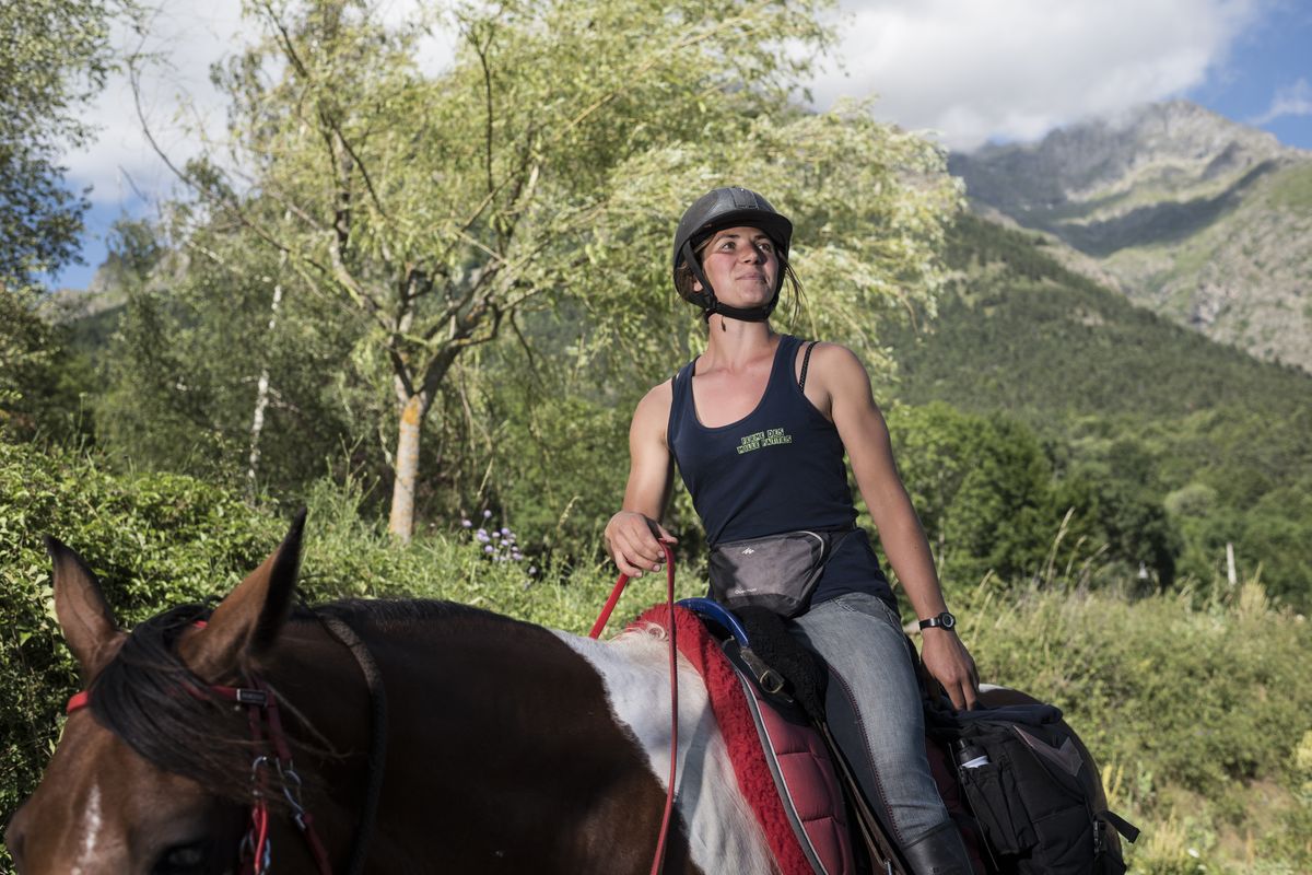
At Les Farelles, the Elevage Régina stud farm breeds endurance pure-bred Arabian horses.
At the Chapel of St-Etienne, at the foot of the Bec de l'Aigle, the Tête de la Madeleine and the Crête de Liéraver form natural borders with Le Dévoluy. Tables, benches, monuments and information panels encourage you to take a break. The horses will graze on the grass and trees, and riders will note the contrast between the limestone rock of the Faraut mountain and the crystalline rock of the mountain in front of them: the Banc du Peyron. The fountain will refresh horses and riders alike.
Access and parking
Parking :
Report a problem or an error
If you have found an error on this page or if you have noticed any problems during your hike, please report them to us here: