Tour de l'Aiguille de Vénosc
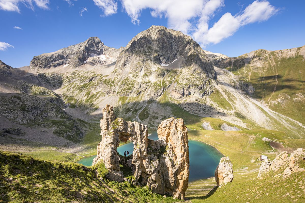
A subtle blend, with bucolic views succeeded by an Alpine refuge on the lakeside, with a glacier looking down, and then the austere panorama of rock and ice of the valley col. Not to mention the pride of completing parts of the famous GR®54 and the privilege of seeing the total reserve of Lauvitel and its impressive mountain lake from above.
Important information
Dans le Parc national des Écrins, les sentiers sont généralement praticables de la mi-juin à fin septembre.
Toutefois, les périodes d'accessibilité des itinéraires et les dates de pose des passerelles varient d’une année à l’autre en fonction de l’enneigement, des dégâts survenus en hiver et des conditions météorologiques.
Par ailleurs, l’état des sentiers n’est pas contrôlé quotidiennement et peut évoluer rapidement après un évènement météorologique (orage, crue...). Il est nécessaire de se renseigner auprès des maisons du parc national et des offices de tourisme du territoire avant votre sortie.
Pendant la randonnée, en cas de passage dégradé ou dangereux, faites demi-tour et signalez-le.
2 steps
Description
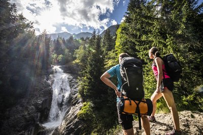
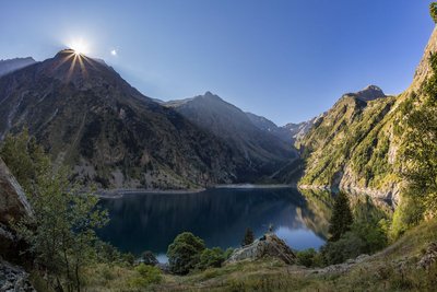
After walking up the little narrow street towards the upper part of the village of Alleau, the climb begins on a fine forest path that then passes above the left bank of the Pisse torrent. The ascent is continuous, but the slope finally flattens out and you arrive at the magnificent corrie of Lake Muzelle with its refuge elegantly placed just above the lake. Both are watched over from above by the Muzelle glacier. After a restful night at the refuge, you start up a fairly steep path that zigzags its way just under the valley pass. Here, take your time to admire the Barre des Ecrins from an uncommon angle. Soon afterwards, the descent looks down almost continually on Lake Lauvitel, with sections that are sometimes fitted with handrails. After Lauvitel “beach” and its pile of stone blocks, the descent towards La Danchère passes along a path that is almost entirely paved and that can get quite crowded. You then return to the village of L’Alleau partly alongside the powerful River Vénéon, in peace and quiet, through the forest.
- Departure : Le Bourg d'Arud
- Arrival : Le Bourg d'Arud
- Towns crossed : Les Deux Alpes and Le Bourg-d'Oisans
Altimetric profile
Recommandations
The best period for this tour is from mid-June to the end of September, when the Muzelle refuge is open.
Ask about weather and snow levels in the col valley in early summer.
Some sections in the descent towards Lauvitel have handrails and can be tricky in wet weather. The same goes for the paved paths in the descent after Lake Lauvitel, which can sometimes be slippery.

 In mountain pastures, protection dogs are there to protect the herds from predators (wolves, etc.).
When I hike I adapt my behavior by going around the herd and pausing for the dog to identify me.
Find out more about the actions to adopt with the article "Protection dogs: a context and actions to adopt".
Tell us about your meeting by answering this survey.
Information desks

Oisans Park house
45 avenue de la République, 38520 Le Bourg d'Oisans
Video presentation of the natural resources of the Oisans mountain and its crafts. Information, documentation about the Park, projections, reading space for children. Accessible to people with reduced mobility. Free admission. All animations of the Park are free unless otherwise stated.
Access and parking
Access to Bourg d'Arud from Bourg d'Oisans 13 km away along the D 1091 (towards Briançon), then D530 (towards Venosc, then Le Bourg d'Arud and St Christophe en Oisans).
Parking :
More information
Source

Report a problem or an error
If you have found an error on this page or if you have noticed any problems during your hike, please report them to us here: