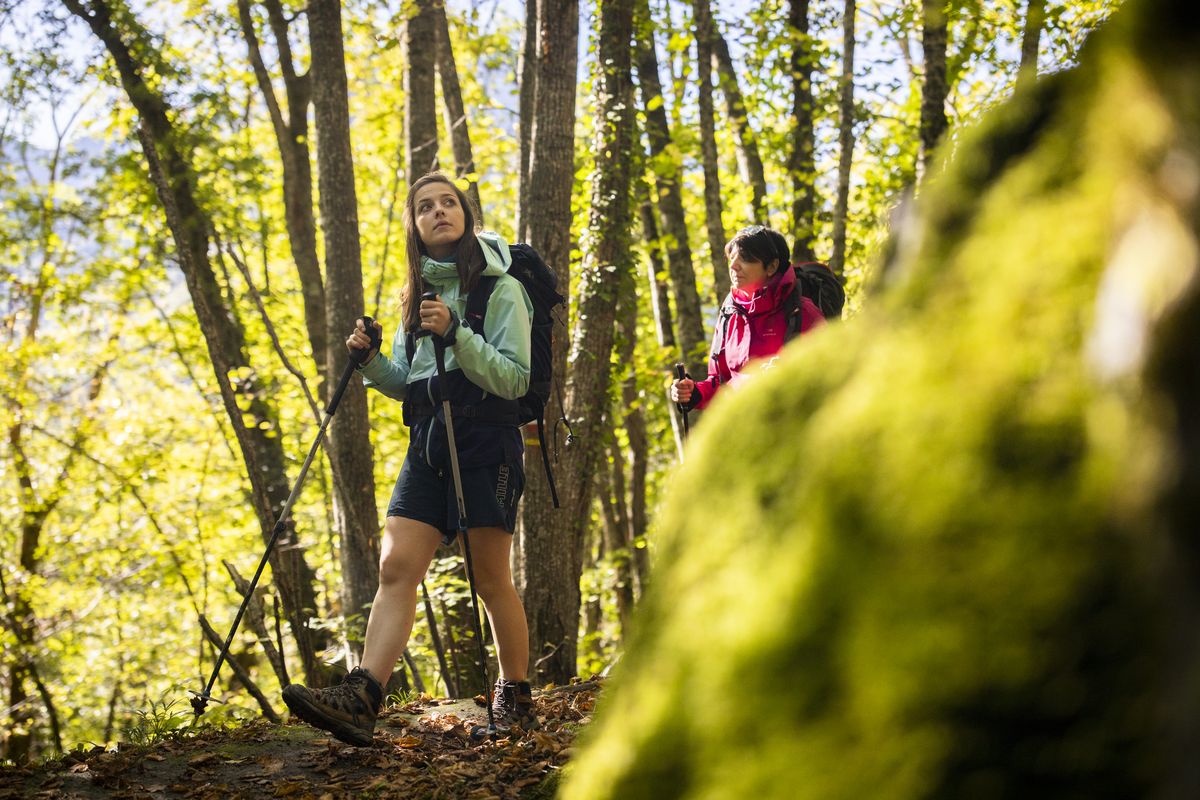
3. From Valbonnais to Les Daurens
Setting off for an encounter with the unusual history of these mountain valleys means first of all following the Canal des Moines, built to manage the waters and irrigate the fields. Then you can explore the varied architecture in hamlets and villages evoking the activities of past times, and then the landscapes, bearing witness to the glaciers that have shaped the valleys. But walking up through these valleys also means exploring the different facets of life in the mountains today.
Description
- There, the path rises (stones) and joins up with a footpath that you follow as far as Les Pinets. Then cross the access road to the village and take the marked footpath. After a short ascent, at the crossroads of several paths, go back down towards Le Périer.
- In the centre of the village, take the road (RD526) towards Col d'Ornon all the way to the end of the village of Les Rambeaux.
- Take the left-hand path and, after a steep upward section on the road, you will arrive at Pont du Gas.
- Cross the bridge and take the steep path towards Col d'Ornon for about 500 m, then follow a narrow path going down towards Les Molles (disused isolated farm).
- Walk around the house upstream, cross the bridge over the Malsanne then take the road as far as Les Daurens.
- In the village, near the fountain, go straight on into Rue de Champ Meyannes. Cross the bridge over the Malsanne and follow the river.
- At the ‘Champ Meyannes’ crossroads, turn left for 100 m and then right onto a track. Follow it to a small meadow and take the path on the right. At the high point, ford the path then descend to the hamlet of La Chalp. In the hamlet, you can make a short round trip to the picnic area and the information panel on the geological site of the Chantelouve fault.
- From here, turn right onto the road that runs alongside the torrent, joining the D526. Cross the bridge over the Malsanne then take the path on the left that runs alongside the river as far as the hamlet of Bosses.
- Cross the wooden bridge, pass the church and follow the road to the junction with the departmental road. Continue downhill for around 200 m. Before the ford, take the track on the right towards Col d'Ornon.
- At the first crossroads, turn right. At an altitude of 1,239 m, rejoin the main road and take the left-hand path in the hairpin bend. The route crosses the road at a reservoir. Continue straight ahead, then turn left and follow the track. After fording the Merdaret, take the track downhill. Two more hairpins and the pass is in sight.
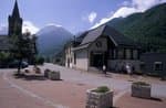
- Departure : Valbonnais
- Arrival : Les Daurens
- Towns crossed : Entraigues, Le Périer, and Chantelouve
3 points of interest
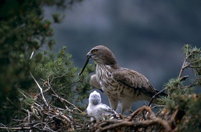
Le Circaète Jean-Le-Blanc rapporte un serpent au nid - © Parc national des Écrins - Robert Chevalier  Fauna
FaunaThe short-toed snake eagle
Spring has hardly begun when high up in the spire a piercing cry is heard. You must raise your head to admire two large birds flying together, alternating acrobatics and motionlessness in the sky, like two silver kites playing with the wind. Their light-coloured, squat silhouette and their darker head help to identify the short-toed snake eagle. They mainly feed on reptiles (lizards and snakes), which they capture by the head and regurgitate to feed their chicks.
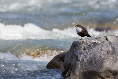
© Parc national des Écrins - Thierry Maillet FaunaWhite-throated dipper
The white-throated dipper is easy to spot, as long as you are discreet. It lives along rivers and mountain streams. A small reddish and grey bird, with a short tail, its beak is slender, and it has a white mark from the chin to the breast. This surprising passerine bird is unusual in walking on the river bed in search of food against the current. It lies flat and grips the river bed with its claws, and with its eyes open, protected from the water by a fine membrane, it can spot worms, larva, small shellfish and fish.
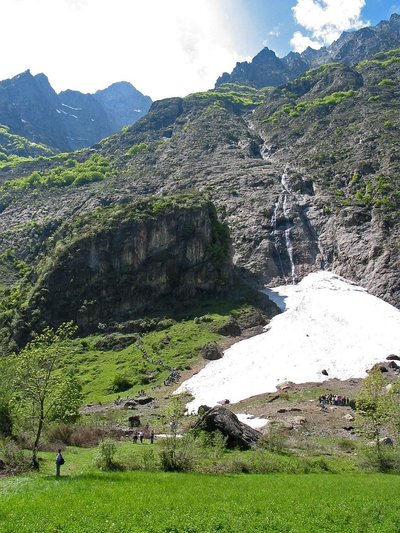
Faille de Chantelouve - © Parc national des Écrins - Jean-Pierre Nicollet  Geology and geography
The Chantelouve fault
In the regions of Chantelouve and Ornon, and continuing further north and south, the Col d'Ornon Fault is a major geological rift that was discovered and interpreted, leading to the completion of the theory of the Alpine chain formation. The geological interpretation of the remarkable site at "La Chalp de Chantelouve" made dating possible and increased understanding of the formation of certain phases of the Alps. In particular, from observations made on the Col d'Ornon Fault, geologists developed the theory of “tumbled blocks" and understood how fundamental geological Alpine accidents took place and their role. Today, many geology students and geologists from France and all over the world come to study this key site.
Altimetric profile
Sensitive areas
Peregrine falcon
- Impacted practices:
- Aerial, Vertical
- Sensitivity periods:
- FebMarAprMayJun
- Contact:
- Parc National des Écrins
Julien Charron
julien.charron@ecrins-parcnational.fr
Short-toed snake eagle
- Impacted practices:
- Aerial,
- Sensitivity periods:
- MarAprMayJunJulAugSep
- Contact:
- Parc National des Écrins
Julien Charron
julien.charron@ecrins-parcnational.fr
Short-toed snake eagle
- Impacted practices:
- Aerial,
- Sensitivity periods:
- MarAprMayJunJulAugSep
- Contact:
- Parc National des Écrins
Julien Charron
julien.charron@ecrins-parcnational.fr
Information desks
Maison du Parc du Valbonnais
Place du Docteur Eyraud, 38740 Entraigues
Reception, information, temporary exhibition room, reading room and video-projection on demand. Shop: products and works of the Park. Free admission. All animations of the Park are free unless otherwise stated.
Source

Report a problem or an error
If you have found an error on this page or if you have noticed any problems during your hike, please report them to us here: