1. Stage 1: Ancelle - Col Bayard Oxygenation Centre
When you get to the Col de Moissière and its fine view over the Gapençais, which can be enjoyed by cyclists all day long, the route runs between Col de Manse and Col Bayard. Many traces of the past can be seen along the way, such as the disused railway line and the Gap Canal.
Description
- A mountainside track with a great view over the Gapençais awaits you in Le Collet and the Ouragnatte picnic area. The route goes northwards around the Puy de Manse, on the Champsaur side. You then cross a surprising, little, low-lying Alpine pasture (watch out for the marmots)!
- Following a short technical descent /!\, you cross the D14 and arrive at the locality of Les Chameaux (near the Col de Manse) and the disused Champsaur railway line that makes its way down towards Gap.
- After the Lac des Jaussauds, cut across the D944 and follow the peaceful Gap Canal for a few kilometres.
- When you arrive at a hairpin bend, turn right onto a track going up to the Col Bayard golf course.One last track takes you to the Col Bayard Oxygenation Centre. Watch out for the golf greens and stray golf balls!
- Departure : Ancelle
- Arrival : Col Bayard
- Towns crossed : Ancelle, La Bâtie-Neuve, Forest-Saint-Julien, La Rochette, and Gap
5 points of interest
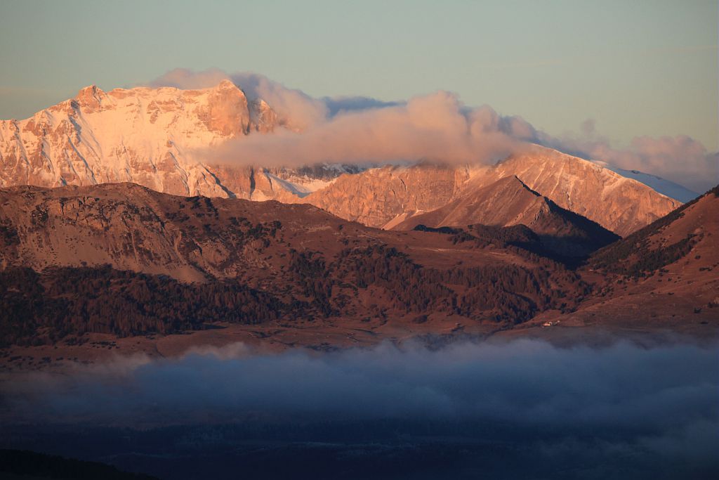
Gap depuis faudon - Marc Corail - PNE  Panorama
View over Gap
To the south of Champsaur, the town of Gap is the administrative centre of Hautes-Alpes, with a little over 40,000 inhabitants. It stands at an altitude of 700 m on a major communications route between Provence and the Alps, and enjoys generous rates of sunshine with large natural areas in the vicinity. In 2013, L'Equipe newspaper voted the town of Gap as France's most sports-oriented town of over 20,000 inhabitants.

 History
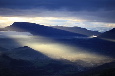
Canal de Gap
Work began on the canal in 1864 and was completed in 1880. The canal is 28 km long, and takes its water from the River Drac, upstream of Pont du Fossé, before channelling it into the Gap basin. In today's money, it cost some 2 billion euros to build! The man in charge of the project, Maurice Garnier, a local member of parliament and contractor, went bankrupt and died in poverty, but managed to improve the life of local farmers.
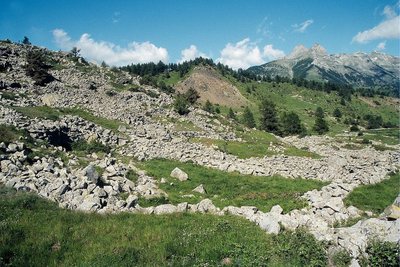
Faudon - les murets et les clapiers d'épierrement - Marc Corail - PNE  Archaeologie
Archaeological site of Faudon
A quick ride takes you past the Croix Saint-Philippe to the remains of the Gallo-Roman village of Faudon, meaning mountain of fayards or beech trees) Settled during the Bronze Age by the Tricorians with a population of up to 400, in the Middle Ages this village became a stronghold for the local nobles before being abandoned in the seventeenth century.
- History
Old Champsaur railway line
1912 saw the start of the Champsaur rail works, an old project for a line between Grenoble and Gap which was intended to pass through Champsaur. In service from 1932 onwards, the Mure to Corps section was an undoubted success. From Corps to Gap, the earthworks and engineering works were almost totally complete. However, the onset of the War, a lack of resources and the development of cars all brought the project to an end in 1941. Today, numerous structures along the route bear witness to this past endeavour.
 Fauna
FaunaMouflon
If you make a detour to the Col de Gleize, you may well see some mouflons. An ancestor of the sheep with ammonite horns, it was introduced from 1949 into the Alps from herds in Corsica and central Europe, and seems well settled in the Chaudun area. Even though the European Union recommends strict protection of the mouflon, it is still hunted during the hunting season. Its populations are ill-adapted to extreme Alpine conditions and can fluctuate according to the winter weather.
Altimetric profile
Sensitive areas
Short-toed snake eagle
- Impacted practices:
- Aerial,
- Sensitivity periods:
- MarAprMayJunJulAugSep
- Contact:
- Parc National des Écrins
Julien Charron
julien.charron@ecrins-parcnational.fr
Source

Report a problem or an error
If you have found an error on this page or if you have noticed any problems during your hike, please report them to us here: