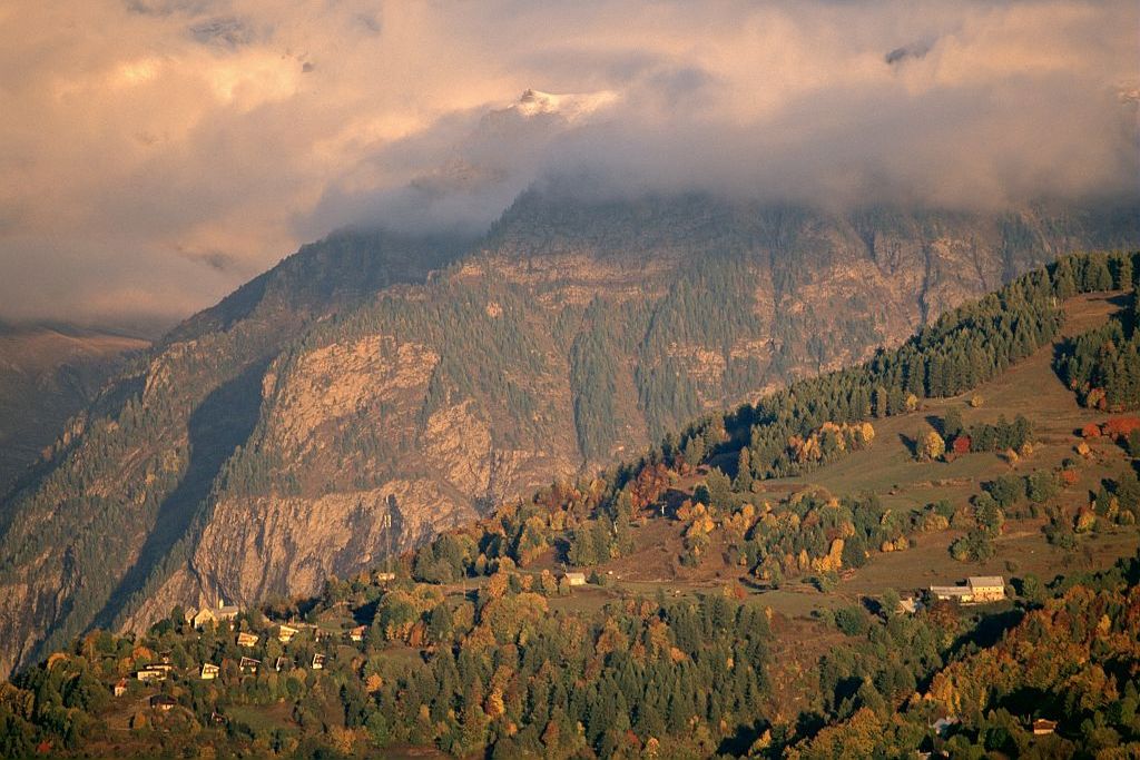
3. Stage 3: Champoléon - Orcières - St Léger les Mélèzes - Ancelle
A shorter stage and a chance to recover from the efforts of the day before! From Les Garnauds to Orcières, gentle ascents and descents follow one another. The slope then rises and you need to call on all your reserves to make your way up to La Croix de la Vire (a panorama rewards your efforts)!! The big climb is now behind you, and you can enjoy the end of the adventure with an easy return trip to Saint-Léger and Ancelle.
Description
- You arrive at the D944a and then follow the Drac Blanc along pathways in parallel with the departmental road. A forest track makes its way gently to Les Garnauds.
- After reaching the Drac Noir, you follow it along the right bank to reach the Orcières leisure centre, the Pont Peyron and the road to Les Audiberts.
- Cross over towards Serre Eyraud on an easy, undulating track.
- Continue up the Serre-Eyraud road and leave it on the right to follow the long track up to Combeau.
- Above the ‘Tante Yvonne’ hut, reach the Croix de la Vire (1900 m) and its superb panorama (avoid approaching the shepherd's hut where the sheep are protected by patous)! Descend the first track, which is fairly steep before becoming increasingly easier.
- After a first crossroads where you should continue downhill (keep to the right), the track makes a hairpin bend and leads to a second major crossroads where you should turn left. The road leads to the small Libouse climb.
- The route then arrives at Saint Léger-les-Mélèzes along a small path. Cross the village near the church and, after going alongside a large beech forest (along a sports trail), you arrive at the top of the Plateau d'Ancelle. One last descent into the village and the tour is complete!
- Departure : Les Borels - Champoléon
- Arrival : Ancelle
- Towns crossed : Champoléon, Orcières, Saint-Jean-Saint-Nicolas, Saint-Léger-les-Mélèzes, Ancelle, and Chabottes
10 points of interest
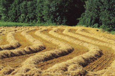
Pré fauché - Stéphane D'houwt - PNE  Pastoralism
Mown meadows
Most of the prairies are mown. They are lightly manured by the animals grazing here in spring and with additional manure. This land is rich in plant species: globeflowers, geraniums, narcissus, etc. The meadows that are only grazed are covered with large plants that are of no interest to cattle: asphodels, yellow gentians, veratrum, etc.
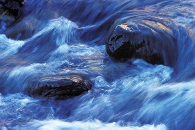
Le Drac blanc - Marc Corail - PNE  Water
WaterDrac Blanc and Drac Noir
The Drac Noir or Drac d'Orcières takes its source at the foot of the Mourre Froid and the Roc Blanc at an altitude of about 1,900 m. The mainly sedimentary rocks in the valley soon turn the mountain stream black ("Noir") when it rains. The Drac Blanc or Drac de Champoléon arises at an altitude of 1,800 m, below the Pointe des Rougnoux. Since the valley is mainly made up of more solid granite rocks, the Drac Blanc ("White") is less clouded than the Drac Noir.
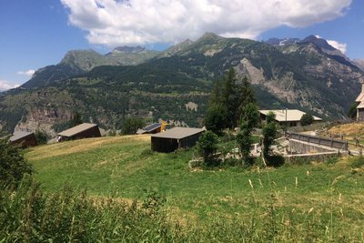
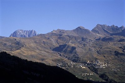
Serre-Eyraud - Parc national des Ecrins - CDTE05  History
Serre-Eyraud
Serre-Eyraud is both a mountain village and a winter sports resort which overlooks
the Champsaur and the confluence of the Drac Noir and the Drac Blanc, 1,450 metres above sea level, opposite the Champoléon valley.
The resort was created in 1962 by a handful of inhabitants: eight runs lead through a larch forest which is exposed to the north, which helps to conserve the snow cover. Serre- Eyraud is the smallest ski resort in the Champsaur valley.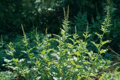
Chenopode du Bon roi Henry - Marcel Chaud - PNE  Know-how
Pastoral plants
Around the shepherds' cabins can be found plants with pale colours that are useful in the kitchen : nettles, which cause rashes, but are used to make delicious soups, wild spinach, also known as Good King Henry , a plant eaten as a gratin (the famous 'oreilles d'âne' (donkeys' ears) dish), with the sour leaves of the Alpine dock. For dessert, the petioles of Monks' rhubarb leaves are served as jams and compotes.
Station Orcière-Merlette - François Labande - PNE HistoryOrcières 1850
Thanks to Camille Ricou, the mayor of Orcières, and a handful of visionaries, in January 1962 the Orcières-Merlette ski resort was born. Soon, buildings, shops and ski lifts were built. Even though the 1960s architecture has not aged well and the pylons disfigure the landscape, the pioneers have achieved their aims: they were able to stay in the region, guarantee their children a future and create jobs.
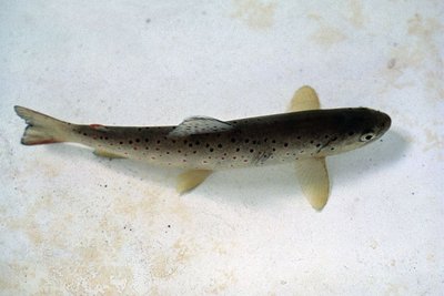
Truite fario - Parc national des Ecrins  Fauna
FaunaTrout
Fishing fans have always loved the Drac. You also need some hiking skills to follow the course of the river or reach the high-altitude lakes. Whether you prefer lure fishing, spoon casting or fly fishing, here you'll find all kinds of trout: brown trout (Salmo trutta), Mediterranean in origin, and rainbow trout (Oncorhynchus mykiss) from North America.
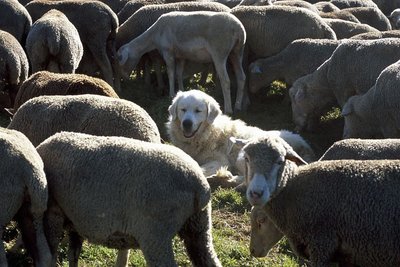
Patou surveillant le troupeau - Jean-Pierre Nicollet - PNE FaunaPatou
The patou is once again being used in the Alpine pastures by breeders and shepherds, following the reintroduction of wolves. Its role is to protect the sheep, not to herd them together like a sheep dog. The dog lives with the sheep from a very young age and considers them as members of its family. It barks and stands between the flock and whatever it sees as a threat. Since it is very protective towards the flock, hikers should make sure they keep their distance.
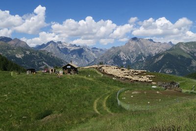
Alpage de Combeau - Parc national des Écrins - Marc Corail  Panorama
The Combeau alpine pasture
The Combeau alpine pasture, lying 2,000 metres above sea level.
Don't miss the superb panoramic view from the Croix de Combeau belvedere.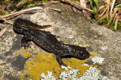
Triton Alpestre - Marc Corail - PNE FaunaAlpine newt
In the Libouze water reserve, newly restored by the town of Saint Léger les Mélèzes, you can see a pretty batrachian swimming around elegantly. This is the Alpine newt. It can be recognised by its orange belly, but unlike the females, the males have lighter-coloured sides with large dark spots and a narrow, light-blue stripe. The species is strictly protected and is becoming rarer in the plain, on the edge of its area of distribution.
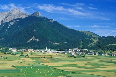
La plaine d'Ancelle - Marc Corail - PNE  Geology and geography
The Ancelle plateau
After the retreat of the glaciers flowing from the Durance and Roanne valleys, the frontal and lateral moraines formed a natural dam at the end of the Ancelle basin. Over time, a large glacial lake was created. Between the fifth and sixth centuries, the lake dried out. The forest then took over the fertile plateau, and it was only in the eighth century that it was deforested by man for crops.
Altimetric profile
Sensitive areas
Golden eagle
- Impacted practices:
- Aerial, , Vertical
- Sensitivity periods:
- JanFebMarAprMayJunJulAug
- Contact:
- Parc National des Écrins
Julien Charron
julien.charron@ecrins-parcnational.fr
Golden eagle
- Impacted practices:
- Aerial, , Vertical
- Sensitivity periods:
- JanFebMarAprMayJunJulAug
- Contact:
- Parc National des Écrins
Julien Charron
julien.charron@ecrins-parcnational.fr
Source

Report a problem or an error
If you have found an error on this page or if you have noticed any problems during your hike, please report them to us here: