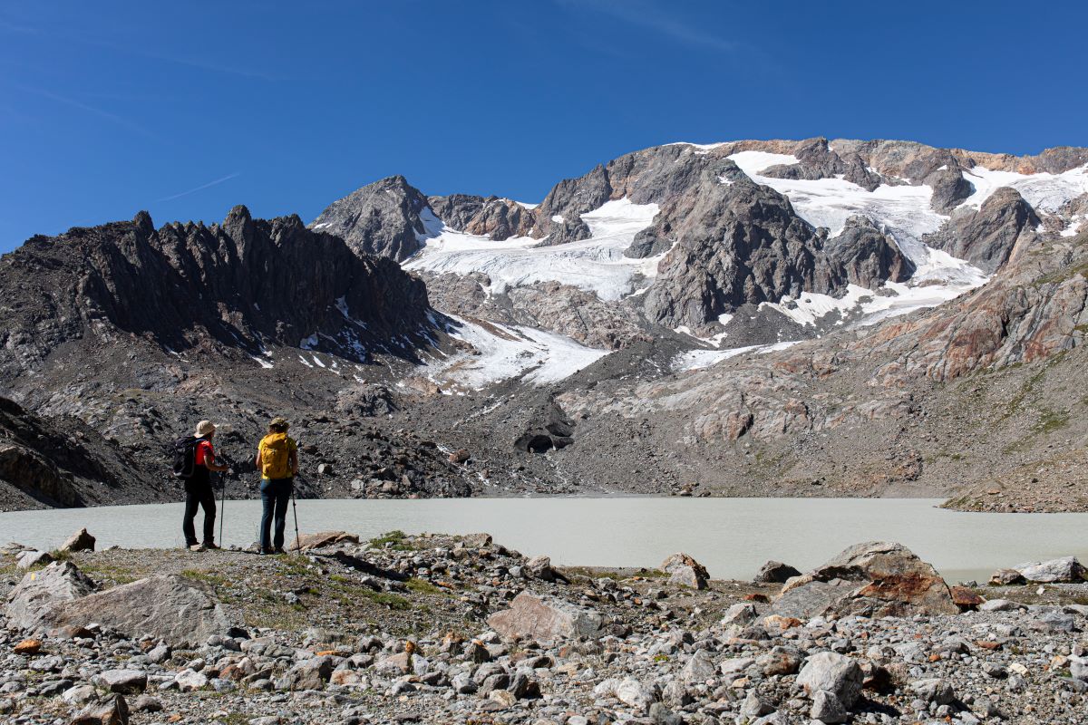
Lake Quirlies
The impetuous Ferrand bridge waterfall sets the scene. There is running water everywhere, irrigating the pastures that thousands of sheep will graze on during the summer. The existence of carcasses means that it is an area well-known to vultures. Higher, the Suirelies glacier and the lake that is surrounded by granite moraines remind us of the high mountains, with a breathtaking viewpoint over the immense Emparis plateau, to the boundaries of l'Isère and La Savoie.
Description
Follow the Sarenne pass road above Clavans-en-haut-Oisans to reach the hamlet of Perron. Park at the information board of the classified site of Le Ferrand. Before leaving with you rucksack, take a look at the house that is backed against the rock.
Set off on the signed footpath to get to the Ferrand footbridge and the majestic waterfall. Head up the wide track overlooking it, then cross another footbridge that leads progressively into a very green valley by staying on the right bank of the stream. The footpath then takes a pleasant route crossing many small streams coming from the higher valleys. Walk successively past the footpath that leads to Clos Chevaleret (a hike for another day), the Bruyères pastoral hut and close to a sheep pen and the bottom of the valley. On this large flat terrain, you will need to cross the stream to head further up to Pierre de l'Oiseau. Leaving the footpath to the Sauvage summit to the right, turn left to follow the one that leads up to the lake. This route is only ice-free as of mid-July. The return trip is made by the same itinerary up to Le Perron.
- Departure : Le Perron (Clavans-le-Haut)
- Towns crossed : Clavans-en-Haut-Oisans
3 points of interest
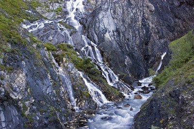
En montant la vallée du Ferrand - Pascal Soulay - PNE  Water
WaterThe Ferrand bridge waterfall
This is an impressive waterfall that reunites all of the Ferrand valley waters. Even when water levels are low, the water flow is still high as the glaciers on the east side of the Grandes Rousses provide a constant flow to the streams.
 Pastoralism
The Bruyère sheepfold
Pastoralism is omnipresent in the entire valley due to the variety of grasses that grow on loose soil made up mostly of shale. 20 000 sheep graze on this vast area during the summer.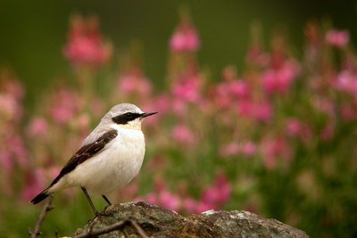
Traquet motteux - Damien Combrisson - PNE  Fauna
FaunaBird's stone
A name that makes you think of the frequent position of the wheatear as it searches for grasshoppers The wheatear is a migratory sparrow that waits until the snow has melted before settling in the pastures. It builds its nest in a small hole in the ground or under turf and rears its chicks before September.
Altimetric profile
Information desks

Oisans Park house
45 avenue de la République, 38520 Le Bourg d'Oisans
Video presentation of the natural resources of the Oisans mountain and its crafts. Information, documentation about the Park, projections, reading space for children. Accessible to people with reduced mobility. Free admission. All animations of the Park are free unless otherwise stated.
Access and parking
At the Chambon dam (N91: Bourg-d'Oisans>Col du Lautaret) turn onto the D 25 go past Mizoën then Clavans-le-Bas and Clavant-le-Haut as far as Perron. From l'Alpe-d'Huez, in the summer, follow the Sarenne road beyond the aerodrome. Go over the pass and down into the Ferrand valley as far as Perron.
Parking :
Source

Report a problem or an error
If you have found an error on this page or if you have noticed any problems during your hike, please report them to us here: